
By: Scott Chalmers, Law Enforcement Officer, New Mexico State Forestry
In the Pecos Basin of southeast New Mexico, a land of empty prairie crossed by a rectangular network of straight roads, the Pecos River threads its way past Roswell on its slow journey to the Rio Grande. Here, the Pecos meanders from side to side across a wide and shallow basin.
Just east of Roswell, Tobias Lucero and I were standing on a bank of the Pecos River, looking out over a former channel that had become separated from the main flow of water. In spring, fish and wildlife seek refuge in these wetlands, where they can spawn and find food. Three days earlier, this landscape had been mostly green.
When we arrived, however, it was burned so thoroughly that it looked as if it may as well have all combusted in an instant. But to Lucero and me, the river bank and what remained around it held all the clues needed to pinpoint the origin and cause of the Patterson Fire, which had threatened ten homes along the river and burned nearly a thousand acres of farmland in May.
Behind many fires, an investigator and a spark
Where there’s smoke, there’s fire; and by extension, fire investigators. My job is to conduct fire investigations for the Forestry Division of New Mexico’s Energy, Minerals and Natural Resources Department. This agency serves the people of New Mexico in many important ways: one of these is to extinguish wildfires that arise on some 43 million acres of state and private lands. It’s a big responsibility. But fire doesn’t always respect administrative boundaries, so firefighters often work together to get the job done. For example, Lucero is a fire investigator working for Bernalillo County; today, he is my partner and mentor.
The investigator’s job is to identify an origin, a cause and a responsible party. And as fires grow larger and more costly to control, their work is becoming more important than ever. In 2011, the Las Conchas Fire burned more than 150,000 acres in north-central New Mexico and cost $48.5 million to put out. It’s up to the wildfire investigator, among others, to decide who gets the bill.
An investigator is part detective and part scientist. They collect and analyze data, test hypotheses, and, until they conclude otherwise, treat every fire as potential arson. Any investigator will tell you, however, that most fires start by accident. There are four basic directions the results of a fire investigation can lead:
· Administrative action to recover firefighting expenses.
· Civil claims to recover firefighting expenses and/or property damage.
· Criminal prosecution.
· To assist in policy development, implementation of fire prevention programs, and pre-fire planning.
Interpreting burn patterns is key to reconstructing a fire’s path
With each new fire, New Mexicans are asking themselves: How did this happen? Walking along the Pecos River, Lucero and I were thinking about three things: weather, topography and fuels. These are the main ingredients of fire behavior, and they form the context within which the investigator considers how a fire ignited and spread.
Our first step was to follow the footprints that the fire left behind as it traveled across the landscape. Only after an investigator has tracked a fire back to its source will he begin searching for clues of the cause. The cause is often something subtle: a cigarette dropped in dry grass, or a fleck of carbon expelled from a car tailpipe.
Lucero and I examined a grove of scorched trees growing on the riverbank. Usually, a fire consumes what burns easily and spares what does not. Here, the fire had grown larger as it advanced; the backsides of the trees were burned more heavily than the fronts.
In front of the trees, a round stone lay wedged in the ground. Behind the stone, some unburned grass had survived; in front of it, scorched earth. As the fire advanced on the stone, it diverged, like a stream flowing around a boulder.
Continuing past the stone, islands of green grass stood out against the black earth. Here and there, a small bush had survived the flames; its yellowed leaves were curled inward toward the heat source. Leaf curls are caused by more mild, slower-moving burns. Picking our way through the scorched landscape, carefully and deliberately, Lucero and I reconstructed the fire’s overall burn pattern.
As wildfires in New Mexico become more frequent and costly to control, the investigator’s work is becoming more important than ever. As it happens, the Patterson Fire wasn’t caused by a person at all: rather, it was lightning. A cloud-to-ground lightning strike generates heat approaching 54,000 degrees Fahrenheit—which is five times hotter than the surface of the sun. One lightning strike, we concluded, found its way into a patch of dry grass, igniting a small fire that likely smoldered for a couple of hours until the wind picked up. Then it was off to the races.
Further Reading
NFPA 921, Guide for Fire and Explosion Investigations 2017. National Fire Protection Association, 2017. Print.
Guide to Wildland Fire Origin and Cause Determination 2016. National Wildfire Coordinating Group, 2016. Print.
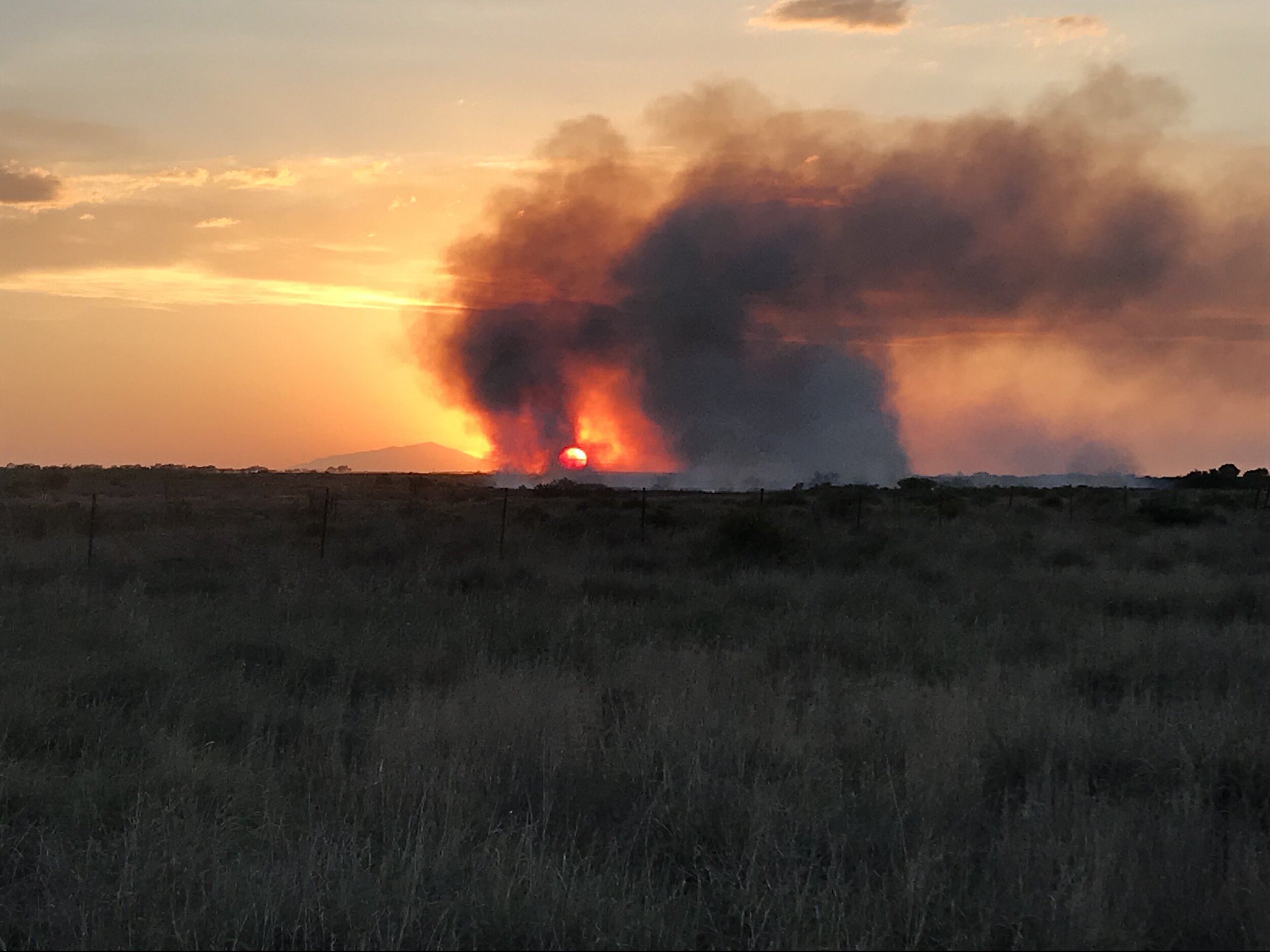
The Patterson Fire burns along the Pecos River near Roswell, New Mexico on May 16, 2019. New Mexico State Parks photo by Joe Desjardins.

A wildfire exhibits many areas of progression. Each area burns with varying intensity and will leave indicators that display a distinct vector characteristic. National Wildfire Coordinating Group diagram.

Fire investigation students place color-coded pin flags like the red, yellow and blue ones in this picture to indicate which direction the fire was moving at a given point. Next, they will search the origin area for physical evidence of an ignition source. New Mexico State Forestry photo by Scott Chalmers.

An example of a fire direction indicator: protection occurs when fuels are shielded from heat damage. Grasses in front of the rock (bottom) seen in this picture were fully exposed to the fire’s advance movement and show a clean burn line. Grasses behind the rock (top) were protected. National Wildfire Coordinating Group photo.

Curling occurs when green leaves curl inward toward the heat source. This usually occurs with slower moving, lighter burns associated with backing and lateral fire movement. National Wildfire Coordinating Group photo.