Wildfire Wednesday #100: Revisiting Local Knowledge about Fire in Our Landscape

Hi FACNM Community,

We are excited to share our 100th Wildfire Wednesdays newsletter with you! 🎂 Over the years, we have used this bi-weekly blog as a forum for sharing resources and best practices across the state. We hope you have found it helpful in your work and we want to thank you for continuing to forward it along to coworkers, friends, family, and neighbors

As we move into the next 100 Wildfire Wednesdays, we want to encourage our readers to please reach out and share resources or success stories with us to highlight. Networks rely on a two-way flow of information and we would love to amplify the great work that you all are doing by featuring it in the Wildfire Wednesdays blog.

For this week’s Wildfire Wednesday we want to feature some local fire and forest science that can support our understanding about the ecological role of wildfire in New Mexico’s forests.

This week’s newsletter includes:

  • A webpage of scientific research relevant to Northern New Mexico

  • A (re)-introduction to the Southwest Fire Science Consortium

  • An interactive webinar (12/15) focused on forest and fire science in the Santa Fe Mountains

Stay safe,

Gabe

A Sampling of Local and Southwest-Focused Scientific Articles and Forest Treatment Reports

Locally-relevant, up-to-date scientific information is essential for ecologically appropriate land management decisions. This includes decisions made on public land as well as those made on private lands — even in our backyards.

Since scientific findings can only be applied to specific context that they were designed for, there is a large amount of research related to fire and forestry. Some studies can provide us with broadly applicable findings, and others may only hold up when they applied to the specific forest that was included in the research. In much of Northern New Mexico, and especially in the Santa Fe Mountains area, we are fortunate to have a wealth of forest and fire science research that was specifically conducted in this landscape. To help provide our readers with some of the most locally-appropriate scientific studies for Northern New Mexico, the Greater Santa Fe Fireshed Coalition developed a webpage that provides a sampling of Local and Southwest-Focused Scientific Articles and Forest Treatment Reports.

Before you dig into the pile of publications listed on the webpage, start by reading these 5 topically diverse forest and fire research publications:

Next, you will find a broader list of northern New Mexico- and Southwest-focused forest and fire research articles as well as local forest treatment success stories below. Review at your leisure for additional science and practical information.

To view the full webpage of research articles, click here.

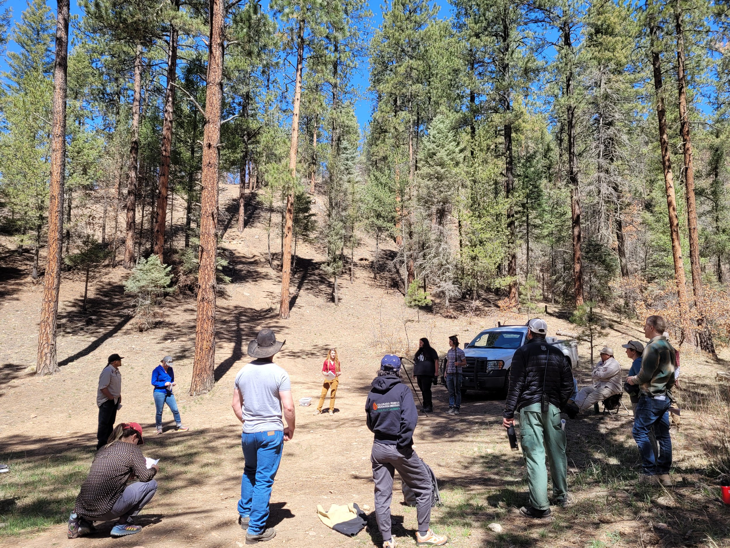
A (Re)-introduction to the Southwest Fire Science Consortium

The consortium is a way for managers, scientists, and policy makers to interact and share science. The goal is to see the best science used to make management decisions and scientists working on the questions managers need answered. The Southwest is one of the most fire-dominated regions of the US, and the Consortium is the only regional organization focused on fire research and information dissemination across agency, administrative, and state boundaries. The Consortium tries to bring together localized efforts to develop scientific information and to disseminate that to practitioners on the ground through an inclusive and open process. Please join the Consortium by attending a field trip or workshop, reading and sharing the materials on their website, and/or contributing to the fire conversation by submitting a proposal for an event or product.

To visit the Southwest Fire Science Consortium’s webpage, click here.

To view a list of publications and resources, click here.

Key objectives

  • Disseminate current science and facilitate its use among scientists, practitioners, and managers

  • Facilitate communication and collaboration among stakeholders

  • Identify and develop knowledge relevant to practitioners, managers, and policy makers

  • Develop methods to assess the quality and applicability of research

  • Demonstrate research on the ground

  • Build place-based adaptive management partnerships that promote adoption of fire science findings by fire, fuel, and land managers

  • Develop mechanisms to assess new research, synthesis, or validation needs

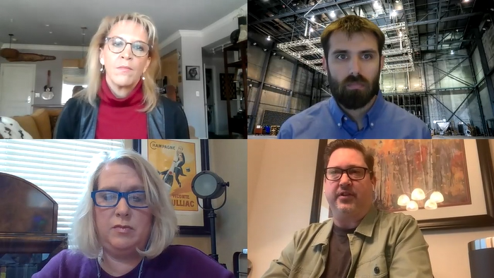
Interactive Webinar: The Ecological Role of Fire in the Santa Fe Mountains

Click here to download and share the flyer!

To join the event, go to the Fireshed’s Facebook page on December 15th at 6pm! To view the event directly and RSVP, click here.

Presentations by subject matter experts with decades of forestry and fire science experience in the Santa Fe Mountains, including:

  • Dr. Ellis Margolis, USGS

  • Dr. Craig Allen, UNM

  • Dr. Tom Swetnam

Craig D. Allen is a research scholar in the Department of Geography and Environmental Studies at the University of New Mexico. He lives in Nambé. Ellis Margolis is a USGS research ecologist working with the Fort Collins research center with in-depth research experience in the Santa Fe Mountains. He lives in Santa Fe. Thomas W. Swetnam is Regents Professor Emeritus, Laboratory of Tree-Ring Research, University of Arizona. He lives in Jemez Springs.


2023 Microgrant Funding Opportunity

Spring 2023 Fire Adapted Communities grant funding: Apply now through January 15!

Calling all FAC NM Members and Leaders

Do you have an interest in promoting and developing your community’s fire adapted practices?
Are you motivated to convene community events but need a little help?

FAC NM is offering grants of up to $2,000 to Leaders and Members seeking financial assistance for:

  • convening wildfire preparedness events,

  • enabling on-the-ground community fire risk mitigation work, or

  • developing grant proposals for the sustainable longevity of their Fire Adapted Community endeavor.

Proposals demonstrating community benefit or FAC capacity building will be considered on a semi-annual basis beginning in January 2023. Grantees will be reimbursed for applicable expenses up to their awarded grant amount.

Grant reporting requirements will include documentation of the event/work, documentation of community participation (if applicable), and creation of a FAC NM blog post.

Round 1 proposals are due by 11:59pm Mountain Time on January 15, 2023. Grantees will have twelve months from the time of award to utilize the funds.

Not eligible? Become a FAC NM Leader or Member today!

If you would like to apply for a FAC NM microgrant but are not sure if you are eligible, read through our FAC NM Membership Structure guide to determine where you fit in the network. To become a FAC NM leader and receive first priority for funding opportunities, visit our Leaders webpage and apply today.

Wildfire Wednesday #99: Wildfire Insurance

Happy Wednesday, FAC NM community!

Navigating the world of insurance for your home, business, or property can feel inherently complex and chaotic. Increasingly destructive wildfires and longer wildfire seasons are adding to the confusion as insurers respond to environmental upsets by changing or dropping their wildfire insurance policies. This week we will be discussing how communities can maintain wildfire insurance coverage by proactively working to protect their assets.

Today’s Wildfire Wednesday features information on:

  • findings from a Wildfire Insurance panel discussion from Montana,

  • a new report on reducing wildfire risk to insurers and the insured through loss prevention,

  • a webinar examining the role of insurance in mitigating the risks of wildfire, and

  • additional upcoming learning opportunities.

Be well and stay curious,

Rachel


Panel Discussion

Promoting and expanding wildfire risk reduction efforts

A panel of representatives from various insuring agencies (American Property Casualty Insurance Association, Insurance Institute for Business & Home Safety, Chubb Insurance) gathered in early 2021 to discuss how to better align the wildfire risk reduction efforts of community leaders and insurance providers. Hosted by the Fire Adapted Montana Learning Network, the group discussed ways to find common ground and forge alliances between Offices of Emergency Management, property owners, and insurers to ensure that everyone is better prepared for and able to mitigate wildfire risk in the wildland urban interface (WUI).

Discussion topics included:

  • how homeowners can live in the WUI and keep or obtain their wildfire insurance coverage,

  • the changing nature of wildfires as they expand further into the urban portion of the WUI,

  • the impact of home construction on personal wildfire risk,

  • increasing costs of wildfire disaster claims,

  • tools for mitigating risk in advance to prevent wildfire losses before they happen,

  • and more!

View the full discussion recording here or play the video below.


Report: Tamping Down Wildfire Threats

How insurers can mitigate risks and losses

A new report out of the Insurance Information Institute delves into the evolving complexities of wildfire threats to homes and properties and how insurers can and should respond. The intent of the report is to provide recommendations for collaborative risk mitigation and to act as a jumping off point for future topical conversations.

The beginning of the report focuses on how wildfires are not just more destructive than in the past: they now behave differently, with three out of the last five years exhibiting some kind of novel fire behavior. Beyond the immediate threat of the fire itself, increasingly intense wildfires tend to destabilize soils, increase flood risk, impact human health and quality of life, and may even be influencing hurricane frequency and intensity along the Atlantic coast. These realities represent a hardship for communities living with fire and a challenge for the insurers facing exponential increases in damage claims expenses.

Insured wildfire losses are on the rise,
but insurers’ appetite for writing coverage in fire-prone areas has declined in recent years; however, ceasing to insure complex risks isn’t a strategy for long-term success. What’s needed instead is risk reduction, pre-emptive damage mitigation, and a deeper understanding of the evolving nature of this hazard.
— Insurance Information Institute

Recommendations to emerge from the report

  • Better mitigation is a starting point

    The impetus is on both at-risk communities and insurers. As the President and CEO of IBHS writes, “to strengthen the resilience of vulnerable homes and communities, adoption and enforcement of wildfire codes and standards must increase.”

  • Uncomplicate claims management

    Accelerating the pace and accessibility of the insurance claims system can make a big difference in how policyholders experience a catastrophic wildfire. Insurers are finding creative methods to process claims and adjust property values remotely to speed up the claims process.

  • Keep an eye on parametric insurance

    “Instead of paying for damage that has occurred, [parametric insurance] pays out if certain agreed-upon conditions are met, regardless of damage. For example, a parametric policy might pay out when a certain threshold of ‘acres burned’ is exceeded”, simplifying the process.

  • Data is the key

    “Climate resilience requires a sophisticated data strategy, yet only 35% of insurers… said they have adopted advanced tools – such as machine-learning based pricing and risk models – that [are] critical to unlocking new data potential and enabling more accurate risk assessments.”


Upcoming learning opportunities

Webinars

November 30 @ 10am MST: Wildfire Risk and Insurance

In the third installment of the “Sparking Solutions” webinar series from Resources for the Future (RFF), experts will discuss the important role that insurance plays in sending signals about risk, how to balance that with equity and affordability, and what options exist for handling the growing problem of insuring wildfire risks.
Register now and revisit parts I and II of the Sparking Solutions series.

December 6 @ 12pm MST: Increases in large wildfire driven nighttime fire activity

Patrick Freeborn will discuss the results of 17 years of active fire data to characterize daytime and nighttime dynamics of wildfires across the continental US. The data indicate that nighttime fire activity in on the rise, largely due to large wildfires influencing local weather to create the conditions for fires to persist through historically cooler and wetter hours.
Register here to attend.

Workshops

November 30 @ 6pm MST: NMAA Workshop - Infrastructure Funding

The New Mexico Acequia Association (NMAA) is hosting a virtual workshop (zoom or phone) on applying for Infrastructure Funding. Register now to learn more about Capital Outlay, ACDIF and RCPP! Questions may be directed to serafina@lasacequias.org

Wildfire Wednesdays #98: Evacuation Planning

Hi FACNM Community,

Evacuation is complex and difficult to plan for. It depends greatly on the type of emergency, or the duration of the emergency, and the needs of the community being evacuated. Fire practitioners, emergency managers, and local community organizations across the country work hard to include flexible evacuation and safety plans into their work each day.

One thing about evacuation is for sure — the more we work within our communities before an incident to plan and communicate about evacuation, the better our response will be. This involves personal wildfire evacuation planning as well as community-level planning.

With this in mind, this week our Wildfire Wednesdays newsletter will focus on both personal evacuation planning as well as planning guides that support community-level planning. We pull in materials from the National Fire Adapted Communities network (thank you!) that we hope will support New Mexico communities in preparing for 2023 and beyond.

Stay safe,

Gabe

Personal Evacuation Planning

For individual residents and homeowners wanting to consider their personal wildfire evacuation plan, the Ready, Set, Go! (en español) personal action guide is a great place to start. This guide helps residents be Ready with preparedness understanding, be Set with situational awareness when fire threatens, and to Go, acting early when a wildfire starts.

The Ready, Set, Go! guide is designed to be prepared well in advance of a wildfire and includes check lists and emergency supplies lists to support communication within your household.

There is a special section about ranches and farms that will help you consider how to evacuate livestock, protect valuable equipment, and more. Animal evacuation takes careful planning and communication to those that live around you. Start these conversations early and check-in about them annually to make sure you have a clear plan.

En Español

Community-Level Evacuation Planning

If you are looking for a resource to help you or your community work through the evacuation planning process, this FREE, 2020 Federal Emergency Management Agency (FEMA) guide is a great start.

Planning Considerations: Evacuation and Shelter-in-Place Guidance for State, Local, Tribal and Territorial Partners.

This guide takes a whole-community approach, provides an overview of key concepts and critical considerations and dives into the planning process itself. 

Communication Resources

Communication Planning

Evacuation and warning wireless emergency alert template in Spanish from California.

If you are looking for tips and tools to help you communicate more effectively during evacuation, there are several great resources available to you: 

  • The Department of Homeland Security document, Best Practices in Wireless Emergency Alerts, contains guidance for establishing wireless emergency alerts as well as information on setting up a training and drilling program.

  • FEMA also has a toolkit available for those who routinely issue alerts and warnings. The Alerts, Warnings, and Notifications Program Planning Toolkit contains a step-by-step, FREE, web-based app that helps you create a customized plan for alerts and warnings. Users can input their own information, guided by prompts and informed by many of the available resources, and then save a Microsoft Word document that can be further edited and refined.

  • The Federal Communications Commission website on multilingual alerting contains general guidance for issuing alerts and warnings in multiple languages. Some states, such as California, have created evacuation alert and warning templates in multiple languages.

Communication Materials for Livestock and Animals

Example of stickers and placards for your home from the ASPCA.

Communication with those residents in rural areas where animals and livestock is a consideration is unique and requires different messaging. Here a few resources specific to that community:  

Modeling and Tools

The Resilience Analysis and Planning Tool Storymap

Our ability to model behavior, traffic flow and evacuation vulnerability continues to increase.  Several tools are available to help communities plan. 

Evacuation Planning for Access and Functional Needs

There is no perfect blueprint for evacuating communities ahead of a wildfire. Even so, there are inclusive planning resources for evacuations to go as smoothly as possible for people with many different needs.

FEMA has a guide specifically for integrating functional needs into general population shelters, and NFPA’s evacuation guide for people with disabilities breaks down planning considerations for specific needs. FAC Net held a recent webinar on how to engage people with access and functional needs in emergencies, covering communication tools and shelter accommodations. Emergency Medical Services for Children (EMSC) has a guide specifically about supporting kids with special needs during a disaster (available in multiple languages).


Engagement Opportunity! November 2022 NM Wildland Urban Fire Summit

2022 New Mexico Wildland Urban Fire Summit

Community Recovery, Cultivating Resilience

November 16-18, 2022


A collaborative group of fire-focused agencies and organizations is presenting the 2022 Wildland Urban Fire Summit (WUFS) in Santa Fe. WUFS is New Mexico’s leading event for wildfire preparedness and planning. This event is tailored to land management professionals and practitioners and is open to the public. Click here to book lodging and click here to learn more about the New Mexico Wildland Urban Fire Summit.

Where: The Lodge at Santa Fe
When: November 16-18, 2022
Cost: $75

Summit highlights:

  • Optional pre-summit tour on Wednesday, November 16th to Pritzlaff Ranch in San Miguel County (only 30 spots available!)

  • Social/networking hour on Wednesday, November 16th

  • Group tour of Santa Clara Canyon on Thursday, November 17th (transportation & lunch provided)

  • Communications & tools/resources tracts on Thursday, November 17th

  • CWPP workshop on Friday, November 18th


Join your peers, community leaders, fire service professionals, and federal, state, tribal, and local governments for this in person event. Learn from local communities adapting to a wildfire environment about the latest techniques, strategies, and resources for wildfire adaptation and resilience. Expand your network of peers and experts to assist you in your fire/disaster resiliency goals.

Travel grants are available for attendees. Go to https://www.swfireconsortium.org/funding/travel-grants/ for more information and to access the application.

Wildfire Wednesday #97: Landscape Collaboratives and Continual Learning

Hello, FACNM community!

Just as your durability as a fire adapted community lies in the melding of each individual’s specialties, strengths, and diverse perspectives, the capacity of landscape collaboratives comes from the unique viewpoints and experiences that each partner brings to the table. Building, maintaining, and encouraging open communication and the exchange of knowledge in these collaboratives is integral to their success.

Today’s Wildfire Wednesday features information on:

  • What is a good starting point for landscape collaboratives?

  • Prioritizing needs and project implementation

  • Continual learning - Wildland Urban Fire Summit 2022

  • Plus, staying informed with webinars and news

Take care,
Rachel


Getting started

What is a landscape collaborative?

Landscape management often spans hundreds of thousands of acres and multiple jurisdictions. Forming a landscape collaborative to address this large scope and the resulting diverse needs allows for creativity, adaptivity, and the capacity to tailor approaches to site-specific conditions. A landscape collaborative can be defined as a multi-party group of stakeholders who share a vested interest in the cohesive management of a defined landscape. These groups may identify as a collaborative, a coalition, a cooperative, or use another term altogether.

A group of individuals stands in a clearing on a sunny day in a ponderosa pine forest

Image courtesy of Alan Barton, 2022. Pictured: Pacheco Canyon Field Tour.

While partners may be united in their desire to care for the land and communities therein, forming and maintaining a landscape collaborative comes with challenges. Necessary factors to ensure the success of the collaborative are upkeep of social relationships among partners (working relationships), legitimate coordination (effective communication), and the collaborative capacity of the community (investing time, energy, and funding sources).

What is a good starting point for forming a landscape collaborative?

Several elements are generally present for a landscape collaborative to form:

  • A shared geographic region

  • Common concerns threatening or requiring attention in that region

  • Multiple individuals or groups with an interest in addressing these concerns

  • Social connectivity between potential partners

  • Resources to enable collaboration, including time, personpower, and facilitation

Convening your group:
Begin by talking to potential project partners, those who you have worked with or who you know share an interest in the same type of landscape management. Identify a meeting space and invite these individuals to discuss common goals, concerns, values at risk, and scope of work and focus area. Figure out who will organize and facilitate meetings of the collaborative to maintain momentum. Identify potential funding sources as appropriate. Once you have convened collaborative partners and established that you intend to work together, you can move on to utilizing existing documents to guide your proposed objectives and actions.

Utilizing the 2020 New Mexico Forest Action Plan

Regions into which state Forest Action Plans fall. Click to see how New Mexico aims to conserve and protect its forests over the long run.
Image courtesy of National Association of State Foresters.

States are required by the USDA Forest Service to develop a Forest Action Plan (FAP) on a recurring 10-year plan cycle. New Mexico’s 2020 plan builds upon the first plan developed in 2010.

The EMNRD Forestry Division worked with many partners to create the 2020 New Mexico Forest Action Plan. It provides an assessment of the current conditions of our natural resources and sets forth strategies that address key issues in forest and watershed management in a changing climate.

Key elements in the FAP which aid in the creation of landscape collaboratives are: 1) the vision and next steps for collaboration between agencies and organizations, 2) identification of priority landscapes and regions, and 3) current landscape and watershed conditions and corresponding risks.

Read more about the 2020 New Mexico Forest Action Plan.


Establishing Priorities

Choosing focus areas

Each stakeholder in the landscape collaborative will likely bring their own distinct priorities to the table. To avoid conflict and find common ground, the group can focus on the following determinants to guide their cohesive priorities.

Places most likely to get funding

Cartoon graphic of hands holding green dollar bills

Once the collaborative moves from the hypothetical planning phase to the tangible, sources of funding will be imperative for implementation of management activities. Identify potential funding sources such as state agreements and grant opportunities, inquire with others as to what types of projects have been most successful in acquiring funding, and focus on landscapes which have been pre-identified as priorities in planning documents by funding groups (such as the Environment Department, EMNRD Forestry Division and USDA Forest Service).

Priority landscapes

Pull out some maps and identify which areas of interest for your collaborative overlap with county, state, federal, and tribal priority landscapes. Look into the assessments which led to those priority designations (watershed vulnerability, fire hazard, etc.) and determine how those fit in with your collaborative’s idea of landscape risk. Start with the FAP priority landscapes and work from there.

Risk modeling and values at risk

Color-coded model of expected value change of a landscape following a fire in the santa fe fireshed

Look for existing geospatial models, data, and published papers which describe the relative risk faced by your landscape of interest. If you have the capacity, consider using existing data or partnering with a group that specializes in risk modeling to produce assessments of risk specific to that area. Identify specific values at risk (homes, infrastructure, recreational and cultural sites, source water, etc.) which may be prioritized for protection.

Environmental clearances

The environmental clearances required prior to project implementation vary by land jurisdiction. On lands owned by the State, land managers must complete heritage surveys and check for Threatened and Endangered species before beginning work on any management activities. On federal lands, managers must go through the requirements of the National Environmental Policy Act. Identifying areas which have already received environmental or NEPA clearances accelerates the implementation process, can make your project more competitive for funding opportunities, and should be part of the prioritization process.


Continual Learning

Wildland Urban Fire Summit 2022:
Community Recovery, Cultivating Resilience

Continual learning and finding spaces which enable exchange of knowledge between land managers are integral to project relevancy, adaptive management, and cross-boundary collaboration. In mid-November, a collaborative group of fire-focused agencies and organizations is presenting the 2022 Wildland Urban Fire Summit (WUFS) in Santa Fe. This event is tailored to land management professionals and is open to the public.

Theme: Community Recovery, Cultivating Resilience
Where: The Lodge at Santa Fe
When: November 16-18, 2022
Cost: $75

WUFS is New Mexico’s leading event for wildfire preparedness and planning. Join your peers, community leaders, fire service professionals, and federal, state, tribal, and local governments for this in person event. Learn from local communities adapting to a wildfire environment about the latest techniques, strategies, and resources for wildfire adaptation and resilience. Expand your network of peers and experts to assist you in your fire/disaster resiliency goals.

Summit highlights:

  • Optional pre-summit tour on Wednesday, November 16th to Pritzlaff Ranch in San Miguel County (only 30 spots available!)

  • Social/networking hour on Wednesday, November 16th

  • Group tour of Santa Clara Canyon on Thursday, November 17th (transportation & lunch provided)

  • Communications & tools/resources tracts on Thursday, November 17th

  • CWPP workshop on Friday, November 18th


Stay Informed

Webinars

December 6 at 12:00 MST: Southwest Fire Science Consortium presents a webinar on Increases in large wildfire driven nighttime fire activity observed across the conterminous United States with Dr. Patrick Freeborn.

Notable press releases

October 12: In New Mexico, Partners Collaborate to End Siege from Megafires

Post-fire resources

New Mexico Highlands University and partners have released a Post-Fire Resource Hub providing information on post-fire hazards and response operations for the Hermits Peak/Calf Canyon Fire.

Wildfire Wednesday #96: What is a Fire Adapted Community?

Communities continuing to be impacted by recent wildfires across New Mexico can find recovery information through the After Wildfire NM website. Additional resources, including documenting your losses, getting debris removed, finding the right contractor, and more are available through United Policyholders and Coalitions and Collaboratives.


Hello and happy Wednesday, FACNM readers!

Living in a fire-prone landscape, sometimes it can feel like you’re being bombarded with a slurry of fire-related acronyms, organizations, and initiatives all vying for your attention - living with fire, fire science consortiums, fire adapted communities, firewise, fire smart, becoming fire ready, fire networks, fire resources. Today’s Wildfire Wednesday aims to help you better become prepared for wildfire by laying out some of the key differences between two primary fire-preparedness initiatives: Fire Adapted Communities and Firewise USA.

Today’s Wildfire Wednesday features information on:

  • Simplifying Firewise and FAC

  • Which one is for me?

  • Plus, opportunities to Learn More through a wildfire solutions webinar series and TNC’s cultural forestry virtual learning event

Best,

Rachel


Simplifying Firewise and FAC

What is Firewise?

The Firewise USA recognition program is administered by the National Fire Protection Association (NFPA) and provides a collaborative framework to help neighbors in a geographic area get organized, find direction, and take action to increase the ignition resistance of their homes and community and to reduce wildfire risks at the local level.

Firewise focuses primarily on homeowner and resident fire mitigation before a wildfire. Their recommended mitigation actions include home hardening, fortification of the home ignition zone, organization of a Firewise community board, neighborhood risk reduction activities, and joining the program as a Firewise USA Site.

Through risk assessments, community organization, and individual and collective action, the goal of Firewise is to effectively lower community susceptibility to fire.

New applications can be completed online at portal.firewise.org. More information on creating a firewise home and community can be found below.

What is the Fire Adapted Communities (FAC) Framework?

Fire Adapted Communities is a comprehensive framework for community wildfire resilience. It is a way of thinking about how to live better with wildland fire. A fire adapted community is one which understands its risk and takes action during all phases of the wildfire cycle - before, during, and after - to be more resilient. FAC was born out of the 2009 National Cohesive Wildland Fire Management Strategy.

View the FAC community resilience framework and suite of actions by clicking on the graphic to the right.

FAC looks beyond residents and individual actions and broadens the scope of what it means to be fire ready.

FAC encompasses the Fire Adapted Learning Network, a peer learning and professional relationship-building initiative. FAC Net connects people to resources and to other practitioners so they can share approaches, tailor strategies for their place, and make a difference in wildfire outcomes on-the-ground. They combine support for on-the-ground project work with professional development, peer learning and coaching, and long-range strategic planning.


Which one is for me?

Choosing the best program for your community

Firewise and FAC grew out of the same need - to build fire ready communities - and there is a lot of overlap between the two initiatives. Firewise is an important program that supports FAC concepts and wildfire resilience and the two approaches compliment one other.

If you, as an individual or community, are just getting started with your fire adapted journey, Firewise offers an approachable and straightforward suite of actions to build leadership, community cohesion, and to encourage people to mitigate their individual risk.

If you are ready to begin interfacing with your peers, learning more about the science, technology, and lessons learned behind wildfire, and want to access additional resources for education, community programs, and comprehensive resilience through all phases of wildfire, FAC will be a good fit.

Your local chapter - Fire Adapted New Mexico - offers involvement at three levels: Leader, Member, and Affiliate. Each level of involvement is associated with increasing expectations, but also a greater pool of resources. Read about the FACNM membership structure and how to get involved here.

Learning networks are formed to facilitate the exchange of information, spark innovation, increase coordination, and bolster members’ ability to adapt knowledge to local challenges. The purpose of the FACNM network is to create a space for people who want to be part of a network to allow for two-way communication and exchange of ideas and lessons learned.


Learn More!

Sparking Solutions Webinar Series

Resources for the Future is hosting a three-part webinar series on Meeting the Wildfire Challenge.

Part 1: The Fuels Management Challenge and Opportunity; Examining the role of fuels management in mitigating the impacts and intensity of wildfires
Watch the recording and read about the conversation here.

Part 2: Reducing Risk at the Wildland-Urban Interface; a conversation exploring the benefits and challenges of addressing the WUI problem
October 12th at 1:00 - read about the webinar and RSVP here.

Part 3: Wildfire Risks and Insurance
Details to be announced. Keep an eye on this webpage to learn more.

Cultural Forestry Virtual Learning

In July of 2022, The Nature Conservancy - New Mexico Chapter held a virtual learning event on Enabling Sustainable Traditional and Cultural Forestry Practices. The event illuminated how Forest Councils in New Mexico allow communities to get the wood needed to heat their homes and cook their meals while improving forest health.

You can now read about cultural forestry through this blog from TNC or by watching a recording of the virtual event here.

Updates on the Calf Canyon Hermits Peak Wildfire

A government spending bill was passed Friday (9/30) which provides an additional $2.5 billion in relief aid to those affected by New Mexico’s largest wildfire. The funds will be distributed through FEMA. Read more about it here.

Wildfire Wednesday #95: Reviewing the Review (on Prescribed Fire)

Communities continuing to be impacted by recent wildfires across New Mexico can find resources and more through the After Wildfire NM website. You can learn more about fire adapted communities, including post-fire recovery, through the Fire Adapted Communities Learning Network.


In fire-adapted landscapes, prescribed fire creates conditions that reduce the intensity of subsequent wildfires, increase suppression success, and reduce firefighter exposure and risk.

Happy Wednesday, FACNM community!

On September 8th, 2022, U.S. Forest Service Chief Randy Moore announced an end to the agency’s 90-day pause on prescribed burning, coupled with a 107-page report reviewing the Forest Service’s prescribed burning program practices. The National Prescribed Fire Program Review covers a lot of ground and makes a series of recommendations for how to improve the safety and regularity of prescribed burning. An essential part of being fire adapted is a commitment to learning, and that means changing our behaviors and way of doing things when there is better science or practical knowledge to guide us.

This year has been extremely difficult for so many here in New Mexico and we recognize that there is a lot of trauma surrounding prescribed fire. Understanding the changes being made and how the agency is responding will help us all to better understand our role in living with wildfire.

Today’s Wildfire Wednesday features:

  • Immediate changes to the USFS prescribed fire program

  • Long-term cultural changes to the program

  • What it all means for prescribed burning in New Mexico

Take care,

Rachel


Time to Act - Implementing Change

Why a federal review of prescribed burning?

The National Review Team’s report is relevant to the actions taken by and protocols of the United States Forest Service. Its findings will influence the way that the agency operates in the near- and long-term. At its core, the intent of this review and surrounding dialog is to improve the practice of prescribed burning for fire practitioner, firefighter, and public safety.

As we prepare for wildfires shaped by our climate future, we need a range of tools and skills to make our landscapes and communities more resilient and ready. These tools include fire prevention, home hardening, forest thinning, expanded options for forest stewardship such as Forest Councils, and also prescribed fire and wildfires which are managed for ecological benefit.

Before learning more about the contents of the national prescribed fire review, please take a moment to learn about the importance, and success, of prescribed burning as a tool in the land management and resilience toolbelt.

How is the Forest Service rethinking its approach to prescribed fire?

The proximate cause of the Forest Service’s 90-day prescribed fire pause and policy review was the 2022 Hermits Peak-Calf Canyon fire and other escaped burns, but the root cause is rapidly changing environmental conditions - drought, extreme wind events and record temperatures - and how they impact fire behavior. These conditions lay the foundation for catastrophic wildfires and may increase the probability of escaped prescribed burns, thus affecting fire implementers’ perception of risk and necessitating an update to how they operate.

Returning fire to fire-adapted - and starved - landscapes is a balancing act, one that requires land managers “be clear about the risk of conducting prescribed burning operations as well as the cost of delaying or avoiding treatments.” The National Prescribed Fire Program Review provides guidance for that necessary update to the prescribed burning Modus Operandi.

Immediate changes to the Forest Service’s approach to prescribed burning include:

An Agency Administrator is the individual who represents a specific agency on a fire. While this person may be in an assigned position, such as the District Ranger or Forest Supervisor, other employees, such as fire staff, can also complete training and a task book which gives them the AA qualification.

1. Improved decision-making processes

  • Instead of authorizing a broad window of time (say a 1- to 2-week period) for a planned prescribed fire, agency administrators (the official responsible for the management of a functional area) will authorize ignitions only for the Operational Period (24 hours) for the day of the burn. For prescribed fires requiring multi-day ignitions, agency administrators will authorize ignitions on each day. Moderate and high complexity burns now require that an agency administrator to be present on-site.

  • Burning at the upper end of the prescription comes with heightened risk and should be avoided. Some practitioners start burning earlier in the day to avoid bumping up against the upper end of the prescription (a set of conditions that considers the safety of the public and fire staff, weather, and probability of meeting the burn objectives), but burn parameters have generally been reaching the upper prescription limits earlier as the air and fuels (duff, grass, twigs, logs, etc.) dry out faster than expected.

  • Recognizing the challenges presented by climate change. As temperatures rise and precipitation patterns shift across the United States, conditions for prescribed fire will change and the potential for fire escapes will grow. Extreme heat events, along with droughts that are more prolonged and severe, will bring less soil moisture, drier fuels, and more potential for undesirable fire behavior. The agency is working to update necessary trainings more broadly, but one essential training element will be the inclusion of the effects of climate change on fire and fuels, drought, and modeling tools.

  • Go/no-go decision-making inflection points will be standardized across the agency for crews making the call on whether or not to proceed with prescribed burns.

  • Existing and future burn plans will be reviewed prior to putting fire on the ground and a technical reviewer must re-approve that the plans reflect current conditions and burn complexity. Additionally, the individuals responsible for organizing and leading burns (burn bosses) will evaluate landscape, weather, and crew conditions immediately prior to ignitions to document that they still meet burn plan specifications.

2. Standardizing practices

  • Communication and reporting, both before and after the burn, will be standardized across the agency to ensure consistency and to minimize the chance of miscommunication or lack of mutual understanding.

  • Briefings, which happen immediately prior to a prescribed burn being lit, will now follow a standard procedure. The review of and report on incidents which are declared wildfires will now be standardized, improving current tracking systems and access to recommendations.

3. Investing in technology for improved planning

  • The Forest Service aims to incorporate PODS (Potential Operational Delineations) as a modeling tool for both wildfire response and vegetative/fuels management planning.

“After more than a century of fire exclusion and under a rapidly changing climate, fire behavior has changed, and damage from wildfire is increasing. With more than a century of forest and fire science to build on, scientists, managers, and communities are refining management options for reducing risks to communities and ecosystems.”

4. More precise risk analysis

  • Fuel conditions on adjacent lands will be considered, as this can reduce a practitioner’s ability to control a fire that moves (escapes) beyond the planned burn area.

  • More consideration will be given to the impact of long-term drought on prescribed fire behavior since the resulting conditions from drought have been cited as a contributing factor in several reviews of escaped prescribed fires. Learn more about the relationship between climate change and wildfire in this peer-reviewed article or through the associated StoryMap by clicking on the picture to the right.

5. More collaboration

  • Failure to communicate and coordinate with neighboring landowners carries it with significant risk. Building off of number 4, neighboring landowners may have good information that they can share on fuels or other environmental conditions which are relevant to prescribed burners. Working with neighbors also provides social license and improved local response in the event of an escape.

  • The review found that “current agreement policies and contracting laws can keep (USFS districts) from finding the resources they need to carry out complex, large-scale, or long-duration prescribed fires”. One solution to this shortfall is increasing avenues for external partners to implement prescribed fire across boundaries by reducing barriers to collaborative prescribed burning with State agencies and others.

6. Transparency

  • Public trust means public transparency, including coordinating with partners and communities and being upfront about why and where prescribed burns are conducted.

  • In response, the Forest Service aims to implement a large-scale messaging and education campaign highlighting the importance of prescribed fire, including transparent communication related to risk, uncertainty, and complexity.


Changing the Culture

Long-term initiatives to improve the culture of prescribed burning

In addition to the immediate recommendations laid out above, the Forest Service is pursuing initiatives which will provide better education, training, and improve the culture of the agency’s prescribed burning program.

Long-term changes to the Forest Service’s approach to prescribed burning include:

1. Development of a national strategic plan for prescribed fire implementation. The plan will include timing and command structure for ignitions and the logistics to prioritize and mobilize resources (crews, equipment, etc.) for both suppression and prescribed burning activities by December 15, 2022.

2. In collaboration with partners, identification of a strategy for dedicating crews to hazardous fuels work and mobilizing them across the country to support the highest priority hazardous fuels reduction work by December 15, 2022.

3. Establishment of a Western Prescribed Fire Training curriculum by January 1, 2023. This curriculum will be built with the interagency fire and research community, Tribes, and other partners to expand on the National Interagency Prescribed Fire Training Center (NIPFTC) headquartered in Tallahassee, Florida

The report’s findings may be summarized in the context of adaptive management: as a learning organization, the Forest Service can reduce risks by

  • intentionally incorporating learning from past escaped prescribed fires,

  • expanding available resources and tools for prescribed burning,

  • enhancing training opportunities, and

  • clarifying the use of reviews of prescribed burns that have become declared wildfires.

These risk-reduction actions will happen concurrently with agency use of congressionally-approved funding and resources to “scale up fuels and forest health treatments - including prescribed fire - in a way that is safe while also recognizing that risks cannot be fully removed from this land management activity.

Instead of creating a culture of risk avoidance, the U.S. Forest Service needs to move forward with clarity about what they can control.

The recommendations outlined above could create more administrative hurdles which may make it harder for the agency to implement prescribed fire in New Mexico and across the West. While fire managers and decision makers are reevaluating the risk of prescribed burning and adopting the findings to increase their odds of success, the agency also recognizes that the “culture will need to change to elevate the priority of prescribed fire and adopt an all-hands approach to using this central tool for fuels reduction and forest resilience.”


Local Impacts

How the report’s recommendations will be felt across New Mexico

While the National Prescribed Fire Program Review refers specifically to changes within the USDA Forest Service, there are ripple effects beyond the federal sphere. Local communities, even those which previously supported the use of prescribed burning, have become more risk-adverse following recent escaped fires. State Land agencies have put their own holds on certification of prescribed burning on State Land Office or private lands. These changes to the greater culture of prescribed fire will take far longer than 90 days to settle, and land managers across all jurisdictions will have to win back public trust with both words and action.

What can be done in the Land of Enchantment to make “prescribed burns a safer and more effective tool”?

  1. Build a robust multi-agency burn workforce

  2. Use better planning and modeling tools

  3. Adapt projects for a changing climate

Collaboration
These steps are dependent not just on incorporating lessons learned into future efforts, but on taking an ‘all-hands’ approach to prescribed fire by investing in partnerships across boundaries, organizations, and thought patterns. A collaborative approach to burning creates room for diverse perspectives, voices, and ability which serve to widen the lens of both capacity and situational awareness. Eytan Krasilovsky with the Forest Stewards Guild captured this sentiment when he stated that management of our forests comes down to “a community of practitioners. I think the events of this year just really solidify that we need to be communicating and working together.” One step in the right direction is that the agency now seeks to expand training not only for Forest Service staff but also local community members who could be certified to participate directly in prescribed burns.

For the Forest Service to successfully confront the Wildfire Crisis Strategy, agency culture will need to change to elevate the priority of prescribed fire and adopt an all-hands approach to using this central tool for fuels reduction and forest resiliency.

It is recognized that prescribed fire needs to change, given an increasing number of unprecedented weather events, such as the heat wave and extreme winds that caused the Gallinas-Las Dispensas prescribed burn to escape and become Hermits Peak Wildfire, which can be at least partially attributed to climate change. Prescribed and cultural burning is also still one of the best tools available to land stewards to reduce the hazard of future catastrophic wildfire.

As people across New Mexico, federal and otherwise, commit to active management of the West’s forests, our commitment needs to include returning fire to the landscape and working with the human communities who live there.

FACNM and the Greater Santa Fe Fireshed stand by these and other policy and practice changes that make prescribed burning safer and more effective. Prescribed fire remains the quintessential tool for reducing wildfire risk and creating resilient fire-adapted landscapes. While success stories are not always highlighted, there are plenty of examples of this tool working as intended.

How the report is being interpreted elsewhere

People across the West and the Nation at large are taking note of the Forest Service’s review and are talking about how it may change prescribed fire landscape culture and operations at large. Click on the articles below to jump into the discussion.

Read the article from the LA Times

Read or listen to the short Marketplace Report

Wildfire Wednesdays #94: Counteracting Wildfire Misinformation

Wildfire Wednesday Whoopsie! This post originally appeared on the Greater Santa Fe Fireshed Coalition blog on Wednesday, September 7th. The FACNM team apologizes for not getting the information to our member community at that same time. Thank you for your attention and please share widely.


There is misinformation

about wildfire, ecosystem health, fire mitigation, and forest resilience in New Mexico. Misleading narratives about wildfire in our capitol city of Santa Fe and beyond have resulted in significant roadblocks to mitigation and resilience projects that address our wildfire crisis. With climate change exacerbating the consequences of each wildfire year, the gamble of this misinformation could come at high environmental and community costs. Today’s Wildfire Wednesday aims to:

  • address misinformation about wildfire, and

  • debunk prominent examples of wildfire misinformation

based on the consensus among scientists as summarized in the recently released Jones et al. (2022) paper and associated table.

Interested in reading more?

The Fireshed Coalition has developed wildfire resources anchored in the best available science for this landscape.

Check out these related materials:


Wildfire mitigation requires accurate information about drivers of wildfire change, the impacts to society and ecosystems, and actions that alter trends. Misinformation confuses people about the causes, contexts, and impacts of wildfire and substantially hinders society’s ability to proactively adapt to and plan for inevitable future fires.
— Jones et al. 2022

Click on any of the photos below to access the PDF versions of this research.


“Misinformation is incorrect or misleading evidence or discourse that counters best available science or expert consensus on a topic. Vulnerability to misinformation is often driven by distrust in media and institutions, and exacerbated by rapid spread over social media…

“Changing our relationship with fire and the risks we face in the 21st century [will require] understanding human behavior as much as… managing ecosystems. We must learn to deal with misinformation about wildfire and develop strategies for limiting its impact on our ability to implement effective wildfire policies.”


Wildfire Wednesdays #93: Back to School

Hi FACNM community,

It is normal to feel overwhelmed and somewhat unsure about how to discuss difficult and potentially traumatic subjects like the 2022 wildfire season. Many New Mexicans were personally affected or know someone who was affected by wildfire this year. With kids heading back to school this August, now may be an important opportunity to talk with the youngest in our community about the ecological role of wildfire and how wildfire behavior is changing. To support these important conversations, this Wildfire Wednesdays includes information on:

  • Teaching: how to talk about fire ecology - the science behind wildfire

  • Preparation: how to get your kids ready for wildfire

  • Coping: how to talk to kids about upsetting news and current events

  • Plus a wildfire graphic novel and coloring book for kids or the young at heart, upcoming wildfire recovery events in the Mora and San Miguel areas, and more!

We encourage you to please share these resources with parents and educators in your network to help them with this difficult subject. Skip to the end for community recovery events for those affected by the Hermit’s Peak wildfire in the Mora and San Miguel County area.

Best,
Gabe

Teaching: breaking down fire ecology

What is fire?

Before we can talk about how fire spreads, we need to understand what fire is. We can feel its heat, smell its smoke, and see its light, but fire is actually not a solid, liquid, or gas. Rather, it is the result of a chemical reaction called combustion. Combustion is the process by which a substance called fuel reacts rapidly with oxygen and gives off heat. There are three components needed for ignition and combustion to occur. A fire requires fuel ­to burn, air to supply oxygen, and a heat source to bring the fuel up to ignition temperature. Heat, oxygen and fuel form the fire triangle. Fire’s heat is the result of super-excited molecules releasing energy in the form of heat as they break and reform their atomic bonds. Smoke is the result of organic material in the fuel being heated to the point that it converts from a solid to a gas. Light is the result of that released energy incandescing, or glowing, and giving off visible light waves at a very high temperature.

How does fire spread?

“After combustion occurs and a fire begins to burn, there are several factors that determine how the fire spreads. These three factors include fuel [what burns], weather [such as temperature and how dry the air is], and topography [the flatness (such as a grassland) or steepness (such as a mountain slope) of the ground]. Depending on these factors, a fire can quickly fizzle or turn into a raging blaze that scorches thousands of acres” (How Wildfires Work).

Fire ecology: the study of fire as a natural part of the ecosystem

Learning about the Calf Canyon Hermit’s Peak Wildfire

Use this interactive story map from the New Mexico Forest and Watershed Restoration Institute to learn about and teach your young ones about the largest wildfire in New Mexico's recorded history and its lasting impacts.

To view the story map, click here.

Preparation: getting ready for wildfire

Preparing an evacuation kit

When a wildfire is spreading quickly and your family receives orders to evacuate, your safety is the top priority. This means you probably won’t have time to go through the house and decide what you want or need to take with you, you will just need to get moving. One key to readiness is “having an emergency supply kit ready to grab on the go, long before a wildfire or other disaster occurs. Keep it easily accessible so you can take it with you when you have to evacuate [and] plan to be away from your home for an extended period of time.” Follow the link to learn how to assemble your kit.

Making a family plan

Figure out before a disaster strikes how the whole family will react. Know how you’ll contact one another and reconnect if separated, establish a family meeting place that’s familiar and easy to find, consider the specific needs of your household, and practice ahead of time! Learn how to make a plan today.

Staying up-to-date on wildfires near you

Now that you’re prepared with an evacuation kit and a plan, you need to know where to find accurate information on a wildfire burning nearby.

The National Wildfire Coordinating Group (NWCG) maintains InciWeb, a website where official responding agencies such as the US Forest Service and NM Forestry Division can announce new wildfire ignitions and update wildfire incidents with location, containment status, acres burned, and evacuation notices. Search by incident name or find an incident on their national map (InciWeb).

New Mexico Fire Information (NM Fire Info) is an interagency effort by federal and state agencies to provide timely and accurate fire and restriction information for the entire state. The aim is to maintain one website where the best available information and links related to wildfire and restrictions can be accessed. Find updates on wildfires in the state, links to other helpful sites, and information on fire restrictions and smoke management (NM Fire Info).

VISIT INCIWEB

VISIT NM FIRE INFO

Coping: how to talk about challenging subjects

“After disturbing incidents like… natural disasters, feelings of panic and fear increase. Extensive news coverage and posts on social media can heighten those feelings, especially in kids and teens. As adults grapple with how to move forward in the aftermath these events, it's important to help kids and teens process them, too.” Follow these General Guidelines for helping your kid(s) cope and find security in the face of upsetting current events.

During and following a wildfire, “routine is disrupted and one's sense of security is undermined. Families and communities should not underestimate the accumulative effects of evacuation, displacement, relocation, and rebuilding”. Talking to your child, providing them with facts and explanations of what fire is and why it happened, and allowing them time to process and ask questions can all help them cope with the stress and fear associated with living through a wildfire. Visit this link to learn how to help children impacted by wildfires.

Additional resources

Graphic novel: create an account on Dark Horse to access this open-source graphic novel. Follow along as Meghan and Alexx encounter a wildfire, experience what it is like to be evacuated, and talk about fire safety in Without Warning! Wildfire Safety Comic.

Coloring book: educational wildland fire coloring sheets, available for download from The Smokey Generation (Wildfire Coloring Sheets).


Upcoming Events

Mora-San Miguel Long Term Recovery Group Zoom meeting

When: Thursday, Sept. 1 (9am - 11am)

What: Community leaders and citizens from Mora and San Miguel Counties are working to assess unmet needs and help people connect with resources. Find out more about the group, which meets every Thursday on Zoom.

Where: Virtual on Zoom

For more information: Email hpccltrg@gmail.com

FEMA Assistance

When: Friday, September 2, (11am-2 pm)

What: Staff on hand from FEMA to help with applications and questions.

Where: Las Vegas Senior Citizen Center, 500 Sabino Street, Las Vegas, NM

Forest Thinning - free post-fire land restoration workshop

When: Saturday, September 10, (8am - 3:30pm)

What: Find out how to decide which burned trees need to come down, what to do with the wood, how to recognize bark beetles and more

Where: Vans available to take participants to the work site. Meet at 7:15 a.m. by the ARMAS parking lot at Highlands University or at 8 a.m. at the San Geronimo Fire Station, 623 CR A3A.

Enroll for the workshop on site or at luna.edu

For assistance, contact Karen Wezwick at 505-454-5308 or email kwezwick@luna.edu

Erosion Control and Soil Amendments at Tedford Farm

When: Friday, September 16, (9am - 12:30pm)

What: Come learn about learn about the impact of erosion control structures and soil amendments! Across the intermountain west, interest has been growing in using organic amendments and native seeding with erosion control structures to increase plant establishment and productivity while ameliorating active head cuts.

Where: La Puebla, NM

Contact CJ Ames, cj.ames@quiviracoalition.org, with any questions.

Register at this link.

Wildfire Wednesday #92: Commitment to Learning

Happy Wednesday, FACNM Community.

As our communities strive to recover from the impacts of recent wildfires and continue to make incremental progress toward risk reduction from future wildfires, we recognize the ongoing importance of knowledge sharing. Workshops, webinars, trainings, and other tools enable us to work together toward a Fire Adapted New Mexico. FACNM is taking a break from our usual Wildfire Wednesday structure to provide information on upcoming opportunities which align with this commitment to learning.

Today’s Wildfire Wednesday features information on:

  • Free post-fire land restoration workshops

  • Webinars from the Southwest Fire Science Consortium

  • Women in Wildfire Training through the US Forest Service

  • Wildland Urban Fire Summit call for presentations

  • Funding opportunity: Community Wildfire Defense Grants

Best wishes,

Rachel


Wildfire Response and Recovery in New Mexico

Post-Fire Land Restoration Workshops

Luna Community College and the NM Forest and Watershed Restoration Institute at Highlands University are partnering to offer two one-day workshops to help landowners with tips and techniques for reducing erosion and restoring forests in burned areas.
Enroll on-site to learn how to manage, treat, and utilize burned forested lands.

For more information, contact Karen Wezwick at (505) 454-5308 or email at kwewick@luna.edu


Southwest Fire Science Consortium

Upcoming webinars

A snow-covered burned forest, half in shadow and half sunlit, with green pine trees visible in the distance
  • Wednesday, August 31 at 1:00pm MDT - Post-Fire Logging in Southern Colorado: Changes to Post-Fire Recovery
    Following a wildfire, successful tree regeneration is mediated by multiple factors, from the microsite to landscape scale. This presentation demonstrates the importance of microsite conditions such as soil moisture and temperature in predicting conifer tree establishment and the impact that post-fire salvage logging can have on these conditions.

Pie chart from the published paper showing vegetation type regrowth following a high-severity wildfire in california versus the southwest

Image courtesy of C. Guiterman, NOAA

  • Wednesday, September 21 at 12:00pm MDT - Vegetation type conversion in the US Southwest: Frontline observations and management responses
    Ecosystems of the western U.S. are experiencing vegetation type conversions (VTC) in response to land-use change, climate warming, and their interactive effects with wildland fire. This presentation discusses VTC challenges, management responses, and outcomes from the collective experience of managers, scientists, and practitioners across the southwestern US.


Women in Wildfire

Training opportunity in Lakeside, AZ

The Apache-Sitgreaves National Forests will be hosting the annual Women in Wildfire Training this fall. This is a fast paced, six-day training where women from around the nation have to opportunity to participate in hands-on wildland fire training in a simulated fire assignment. Anyone is welcome to apply, no experience necessary. After the completion of the training, students become certified as FFT2 (Firefighter Type 2) and will be provided with information on how to apply in USAjobs if interested in working on a fire crew.
Time and travel are paid, and equipment is provided.

Where: the Pinedale Work Center on the Lakeside District of the Apache-Sitgreaves National Forests.

When: Friday-Sunday, Sept 23-25 and Sept 30-Oct 2; participants must attend both timeframes.

How to apply: visit the wildland fire learning portal by August 21st.

If you have any questions, please contact Naomi Corkish at naomi.corkish@usda.gov / (928) 333-6247) or Matt Sigg at matthew.sigg@usda.gov / (316) 617-9898.


Wildland Urban Fire Summit 2022

Community Recovery, Cultivating Resilience:
Call for submission of presentation proposals!

WUFS logo with colorful "W U F S" letters and white "wildland urban fire summit" imposed against a black silhouette of the state of new mexico

The New Mexico Wildland Urban Fire Summit invites you to share experiences and lessons learned that will help others who share similar challenges in New Mexico’s rural and urban wildland interface. Please consider submitting a proposal that focuses on this year’s theme: collective recovery from wildland fire effects and how to build capacity for the future to adapt and respond to a longer and more intense fire season and its impacts. Presentations may range from 15 minutes to one hour and should be non-judgmental and solution oriented.

Audience: fire service volunteers and professionals, non-profit conservation groups engaged in fire adaptation, and federal, state, and local government representatives.

Submission Requirements:

  • Maximum 20-word title (including subtitle) of presentation/video

  • Maximum 100-word description of presentation/video

  • Speaker biography (1-3 sentences)

  • Audio/visual needs (or other needs)

  • Note: prerecorded videos will be accepted for consideration

All submissions due by Monday, September 12, 2022

For more information, contact Aelysea Webb at NM Counties: 505-310-3564 or awebb@nmcounties.org


Community Wildfire Defense Grants

A primer on preparing to apply

What are Community Wildfire Defense Grants?

The Community Wildfire Defense Grants (CWDG) are intended to help at-risk local communities and Tribes plan and reduce the risk against wildfire. The program prioritizes at-risk communities in an area identified as having high or very high wildfire hazard potential, are low-income, and/or have been impacted by a severe disaster. Applications are due Oct. 7, 2022.

There are two primary project types for which the grant provides funding:

  1. The development and revision of Community Wildfire Protection Plans.

  2. The implementation of projects described in a Community Wildfire Protection Plan that is less than ten years old.

Before proceeding with this grant opportunity, determine if the program is the right fit for your community:

  • The application must come from a local government, Tribe, non-profit organization (including Homeowners Associations), State forestry agency, or Alaska Native Corporation.

  • Project work must occur on non-federally administered land. Work may occur on lands held in trust for Native American Tribes and individuals.

The decision tree (right) can help you identify opportunities. Learn more through the Fire Adapted Communities Learning Network.

Wildfire Wednesdays #91: The Home Ignition Zone

Hi FACNM Community,

With all the devastation and grief of the 2022 wildfire season, it is normal to feel overwhelmed and debilitated when thinking about wildfire risk. We recognize the real frustration and danger that many are feeling related to the consequences of public land management. In light of all of this, we need to keep making incremental progress toward wildfire risk reduction by taking action on our properties and talking to those in our communities about wildfire. Our options are to do the work ourselves by following defensible space and home hardening principles or to work with contractors in our area to reduce wildfire risk on our properties.

This blogpost will share some resources to support you, your loved ones, and those in your communities/neighborhoods in your efforts to reduce wildfire risk on your property. Read on for:

  • The Home Ignition Zone

  • Home hazard assessments

  • International WUI codes

  • Community Wildfire Defense Grants - new funding opportunity

Stay safe,

Gabe

The Home Ignition Zone - Residents

The Home Ignition Zone encompasses the concepts of home hardening and defensible space. Home hardening involves the materials that you build with and the receptivity of your structure to ignition from flames, embers, and radiant heat. Defensible space is the buffer that you create between your home and the vegetation that surrounds it. By working on these two components, we can make a meaningful reduction in the risk of home loss from wildfire. Remember, up to 90% of ignitions from wildfires are caused by embers blown by the wind, so be sure to think of where embers may collect and start your home/property on fire.

Proper defensible space provides firefighters with a place to defend your home. We encourage homeowners to take the concept one step further and plan to have your home survive wildfire even if there are not firefighter stationed around it — this is type of planning could be called survivable space. The following information about defensible space is courtesy of the National Fire Protection Association.

Immediate Zone

“The home and the area 0-5’ from the furthest attached exterior point of the home; defined as a non-combustible area.  Science tells us this is the most important zone to take immediate action on as it is the most vulnerable to embers. START WITH THE HOUSE ITSELF then move into the landscaping section of the Immediate Zone.

  • Clean roofs and gutters of dead leaves, debris and pine needles that could catch embers.

  • Replace or repair any loose or missing shingles or roof tiles to prevent ember penetration.

  • Reduce embers that could pass through vents in the eaves by installing 1/8 inch metal mesh screening.

  • Clean debris from exterior attic vents and install 1/8 inch metal mesh screening to reduce embers.

  • Repair or replace damaged or loose window screens and any broken windows Screen or box-in areas below patios and decks with wire mesh to prevent debris and combustible materials from accumulating.

  • Move any flammable material away from wall exteriors – mulch, flammable plants, leaves and needles, firewood piles – anything that can burn. Remove anything stored underneath decks or porches.”

Intermediate zone

5-30’ from the furthest exterior point of the home. Landscaping/hardscaping- employing careful landscaping or creating breaks that can help influence and decrease fire behavior

  • Clear vegetation from under large stationary propane tanks.

  • Create fuel breaks with driveways, walkways/paths, patios, and decks.

  • Keep lawns and native grasses mowed to a height of four inches.

  • Remove ladder fuels (vegetation under trees) so a surface fire cannot reach the crowns. Prune trees up to six to ten feet from the ground; for shorter trees do not exceed 1/3 of the overall tree height.

  • Space trees to have a minimum of eighteen feet between crowns with the distance increasing with the percentage of slope.

  • Tree placement should be planned to ensure the mature canopy is no closer than ten feet to the edge of the structure.

  • Tree and shrubs in this zone should be limited to small clusters of a few each to break up the continuity of the vegetation across the landscape.

Extended zone

30-100 feet, out to 200 feet. Landscaping – the goal here is not to eliminate fire but to interrupt fire’s path and keep flames smaller and on the ground.

  • Dispose of heavy accumulations of ground litter/debris.

  • Remove dead plant and tree material.

  • Remove small conifers growing between mature trees.

  • Remove vegetation adjacent to storage sheds or other outbuildings within this area.

  • Trees 30 to 60 feet from the home should have at least 12 feet between canopy tops.*

  • Trees 60 to 100 feet from the home should have at least 6 feet between the canopy tops.*

Home Hazard Assessment - Fire Departments

There are many programs for home hazard assessments. A good place to start is to reach out to your local fire department, a local soil and water conservation district, or a wildfire risk reduction organization to see if they offer a home hazard assessment walk-through to help you better understand how to reduce your wildfire risk. This type of program may not exist in your area. To support people that may not have access to a walk through, the Guild created a Home Hazard Assessment Guide.

This guide provides homeowners with tools to assess your home's wildfire risk and prioritizes actions you can take to reduce that risk. The assessment worksheet included with this guide is intended to help you understand your risk and where vulnerabilities on your property may lie. Every home is different in terms of wildfire risk and hazards. The goal for this worksheet is not to get a hazard rating of zero, but simply to address certain vulnerabilities that present a wildfire risk to your home. Where you choose to reduce risk on your property is specific to your property's unique features. Start by inquiring with your local fire department about wildfire risk in your area. Your community may have a Community Wildfire Protection Plan (CWPP) which will provide you with a CWPP ranking and recommendations for reducing risk in your community.

Use the Home Hazard Assessment Guide and the Home Hazard Assessment Worksheet (to be used with guide) to analyze your risks and develop a plan for action.

Developed in partnership between the Wildfire Network and the Forest Stewards Guild

Wildland Urban Interface Codes

In New Mexico, many communities have existing adjacent to forested areas for centuries. In newer areas, population growth and expanding urban development have increased the contact between humans and wildfire.

For those that work in county or municipal governments, or those that would like to advocate for more wildfire adapted development in your area, the International Wildland-Urban Interface Code (IWUIC) is a good place to start. The IWUIC is referenced in many community wildfire protection plans (CWPPs) across New Mexico.

The IWUIC is a model code that is intended to be adopted and used supplemental to the building and fire codes of a jurisdiction (e.g. county, or municipal government). The unrestricted development of property in the WUI is a potential threat to life and property from wildfire and resulting erosion. The objective of the IWUIC is to establish minimum special regulations to safeguard life and property from intrusion of wildland fire into communities.

Community Wildfire Defense Grants

Stakeholders in Colfax County discuss wildfire risk and treatment priorities

As you may know, on July 26, 2022, Agriculture Secretary Tom Vilsack formally announced the new $1 billion Community Wildfire Defense Grant (CWDG) program. This new, five-year, competitive program funded by President Biden’s historic Bipartisan Infrastructure Law is designed to assist at-risk communities, including Tribal communities, non-profit organizations, state forestry agencies and Alaska Native corporations with planning for and mitigating wildfire risks.

There will be a series of webinars August 4th, 8th and 9th to provide potential applicants with an overview of the grant program.

The registration links for the applicant webinars just went live earlier today, so folks may now register.  The dates/times below are the ones that have been posted on the CWDG website. Here is the link to register, and the attached document should walk you through the registration process:

Community Wildfire Defense Grant Program Applicant Webinars

Upcoming Webinars for Applicants

  • Northeast-Midwest States: August 4, 2022 at 10:00 a.m. (Eastern Time)

  • Western States and Territories: August 8, 2022, at 2:00 p.m. (Eastern Time)

  • Southern States: August 9, 2022, at 10:00 a.m. (Eastern Time)

  • Tribes: August 9, 2022, at 2:00 p.m. (Eastern Time)

For instructions on how to register for these webinars, click here.

Wildfire Wednesday #90: Community Forestry

Following a devastating start to the 2022 fire season, New Mexico residents are facing the challenging reality of wildfire recovery. A Hermit’s Peak/Calf Canyon flood warning map is available from Highlands University. Those affected by recent and ongoing fires can learn more by visiting the After Wildfire (afterwildfirenm.org) website. Mental health resources are also available from our last Wildfire Wednesdays post. Finally, refer to the bottom of this blog post for land restoration workshop opportunities happening now for landowners impacted by the Hermit’s Peak/Calf Canyon Fire.


Hello FACNM community,

We hope you’re staying cool as the hot summer days fly by. This week we will be introducing an often-overlooked niche of land management: community forestry. This concept involves local communities as active participants in the stewardship of surrounding forested lands. It also helps build capacity to meet multiple objectives - reducing fire risk, improving forest health and habitat, and maintaining cultural and community vitality.

This week features information on:

  • Existing community forestry programs in the West

  • Forest Council initiatives in New Mexico

  • Opportunities to learn more about community forestry, other community-led initiatives, and funding for community forests

  • Past examples of how communities have come together for post-fire response and recovery

Take care and have a wonderful Wednesday,

Rachel


Existing Community Forestry Programs

How can we learn from the paths that others have already forged?

The exact configuration of community forestry initiatives - the land jurisdiction, leadership, and their objectives - can vary widely. Here are a few highlights from those who have led by example.

Mt. Adams Community Forest: A new model of forest ownership for the West

A checkerboard satellite map with land ownership boundaries overlaid

Land ownership in the vicinity of Mt. Adams Community Forest: image courtesy of Mt. Adams Resource Stewards

Established in 2011, Mt. Adams Community Forest is the State of Washington’s first nonprofit-owned working community forest. The project began with an opportunity and subsequent fundraising to purchase the 100-acre Glenwood Valley’s Mill Pond property with its productive forests, restoration opportunities, water, and recreation resources. A few years later, community members and friends of Mt. Adams Resource Stewards (MARS) rallied again to purchase an adjacent 285-acre block in the form of Pine Flats Forest, followed by additional acquisitions in 2020. While the group is continually looking for opportunities to grow the forest through future land acquisitions, their focus is on growing a locally meaningful model of conservation and stewardship.

In their words, “the Mt. Adams Community Forest strives to permanently protect high community- and conservation-value forests critical to the quality of life of [south-central Washington]. Management goals for community forest properties are centered around principles of land stewardship, community benefit, and healthy functioning ecosystems. Such goals recognize the value of sustainably managed forest resources as a renewable source of wood products and jobs, balanced with the provision of habitat for flora and fauna, and public access for recreation. Tradition is an important element of the Mt. Adams Community Forest vision, and activities such as fishing, hunting, and firewood gathering are provided for when possible.”

Flowering bushes of purple and yellow color the understory of a pine forest with scattered woody debris and oak trees

Pine Flats Tract: image courtesy of Mt. Adams Resource Stewards

While management of the forest is carried out by the nonprofit landowners, Mt. Adams Resource Stewards, community members provide guidance on management priorities through public listening sessions and direct recommendations from their community advisory committee.

Western Klamath Restoration Partnership

“The Western Klamath Restoration Partnership (WKRP) began in 2007, focusing on in-stream fish habitat restoration of the Middle Klamath River sub-basin. It became a 1.2-million-acre upslope restoration collaborative incorporating an “all lands” approach to address threats to people, property, cultural and natural resources at risk of high-intensity wildfire.” It has since grown in scope and size to include more partners, entire landscapes, and objectives, but stays true to its original intent: to build trust and a shared vision for restoring fire resilience at the landscape scale.

Flowchart showing conservation measures partnership open standards: 1 conceptualize, 2 plan actions and monitoring, 3 implement actions and monitoring, 4 analyze, use, and adapt, and 5 capture and share learning

Visualization of the Open Standards Process for Conservation. Image courtesy of the Western Klamath Restoration Partnership

The WKRP is a unique project which began as a community-stewardship initiative and has expanded into a multidimensional collaborative of diverse stakeholders. Their trajectory offers many lessons learned, such as finding common ground through identification of Zones of Agreement (geographic areas where all parties agree upslope restoration needs to occur). Through honest dialogue using Open Standards Process for Conservation, they have been able to create a plan for restoring fire resilience at the landscape scale which is founded upon Traditional Ecological Knowledge (TEK) and practices and concepts outlined in the National Cohesive Wildland Fire Management Strategy.

A map showing the WKRP's geographic area, land ownership, and project plans.

Geographic scope and planning area of the Western Klamath Restoration Partnership. Image courtesy of WKRP.

A hallmark of the partnership “is the Karuk Tribe’s knowledge of fire, passed down from generation to generation. This ‘traditional ecological knowledge’ (TEK) shows us that traditional human/fire relationships of our past can guide the strategies of our future. Representatives from the Karuk Tribe, Mid Klamath Watershed Council, Salmon River Restoration Council, and the US Forest Service are co-leads of the collaborative group, but many other stakeholders, communities and organizations are involved.”


New Mexico Forest Councils

Forest Councils lay the groundwork for local residents to actively steward forested lands as a way to protect water, property and their way of life. While the Councils represent a broad and customizable organization structure, they consistently fill the role of providing governance and leadership for community-forestry efforts.

Cerro Negro Forest Council

A nonprofit entity led by representatives from five local organizations, “the Cerro Negro Forest Council represents residents of Valdez, San Cristobal and Gallina Canyon in their efforts to improve forest health and prevent devastating wildfires in parts of Taos County, New Mexico… The council has adopted the principles of acequia water management and are applying those principles to community-led forestry as a way for locals to generate an income from wood products while improving the health of their forests and watersheds.” Established in 2018, the Forest Council structure is modeled after a community-based forest stewardship program which ran for many years out of the U.S. Forest Service - Camino Real Ranger District.

Cerro Negro puts this model of community-led stewardship into action through implementation of their Forest Mayordomo Collaborative Forest Restoration Program project. Local woodcutters, or leñeros, are assigned and made responsible for thinning of small forested blocks on federal land. In return they receive a per-acre work stipend and can harvest all woody material they cut. This work is carried out under the supervision of the Forest Council’s mayordomo and asistante to ensure that treatments comply with the rules and regulations of the U.S. Forest Service.

Rio de Las Trampas Forest Council

Modeled after the successful Cerro Negro Forest Council and brought back home to the Camino Real Ranger District, Rio de Las Trampas’ mission is “to foster collaboration and community involvement in forest and watershed health projects through the implementation and administration of stewardship agreements.” Their work is driven by the understanding that climate change, intense wildfires, unnaturally dense forests, and drought threaten the lands that support their communities.

A multi-generational family poses atop a pile of firewood

A wood pile in El Valle gathered through the original USFS community forestry program which led to the creation of the Forest Councils. Photo by Kay Mathews.

The Council knows that “it is possible and replicable to partner with federal land managers to accomplish thinning objectives and reduce wildfire risk while providing a maximum benefit to local residents” and puts this knowledge into practice through their 2019 CFRP Supporting the Rio de Las Trampas Forest Council’s Leñero Program. This project replicates Cerro Negro’s Forest Mayordomo CFRP by training, educating, and paying local leñeros to thin and treat acres of federal land. In the end, this project aims to “provide fuelwood to the community, achieve forest thinning goals, and offer local residents the opportunity to care for the land”.

Read more about the Rio de Las Trampas Forest Council’s model of community forestry.


Learning Opportunities

Deep-dive into the world of community forestry!

An up-close view of a small-diameter aspen log deck

Photo by Scott Ishimara, copyright.

Empowering Community-led Forest Stewardship webinar on July 28, led by The Nature Conservancy, New Mexico. Healthy forests and wood products are essential to sustaining our communities and traditional use practices in New Mexico, but access to forests has been inhibited by multiple barriers. To address those challenges and discuss opportunities, The Nature Conservancy is hosting a free virtual event, generously supported by the Taos Ski Valley Foundation.

Get funded through the USDA’s Community Forest Program

“The Community Forest Program (CFP) is a competitive grant program that provides financial assistance to tribal entities, local governments, and qualified conservation non-profit organizations to acquire and establish community forests that provide community benefits. Community benefits include economic benefits through active forest management, clean water, wildlife habitat, educational opportunities, and public access for recreation.”

This program funds establishment of private forest lands for community use which meet certain qualifications. Mt. Adams Community Forest, the program highlighted in the first section of this newsletter, is funded in part by the CFP!

Learn about the community’s role in stewarding our urban forests

The New Mexico Energy, Minerals, and Natural Resources Department runs and Urban and Community Forestry Program to help communities develop and sustain healthy urban forests.

A planted seedling in the foreground against the backdrop of the shovel used to plant it

Image courtesy of NM EMNRD

They expand the definition of community forests to include all trees, vegetation, and associated natural resources within and around an inhabited area. Community trees include park trees, trees along streets and neighborhoods, and any trees within the wildland-urban interface between communities and adjacent forestlands.

The services offered by the Urban and Community Forestry are borne of the understanding that urban forests deliver tremendous value to communities and the people that live there. Trees contribute to reduced storm water runoff, improved air and water quality, increased property values, improved quality of life for citizens, increased economic development opportunities, and reduced energy use at homes and businesses.


Post-fire Community Response and Recovery

How can the community come together following a wildfire?

As a community, the other side of fire preparedness is how we come back together to respond to, recover from, and maintain our culture and traditions following a fire.

Learn about one Tribe's collaborative journey to develop forest resiliency and how Santa Clara Pueblo Forestry has been able to incorporate lessons learned from past wildfires into new Fire and Forest Management Plans to keep fire an active component in maintaining the landscape.

One takeaway from Santa Clara Pueblo’s experiences is that adapting to wildfire needs to happen both before and after the fire. Lindsey Quam and Gabe Kohler took that to heart and offer low-cost strategies for flooding and erosion mitigation is this 2019 FACNM article. These methods were part of a landscape-scale effort to mitigate flooding and erosion after the 2011 Los Conchas fire but are powerful tools for response and recovery that can be used to leverage the people-power in any community and make an impact against flooding and erosion before it occurs.

For landowners impacted by the Hermit’s Peak/Calf Canyon Fire, Luna Community College and the Forest and Watershed Restoration Institute (FWRI) are offering a free workshop series on land restoration techniques, happening now. The workshops will cover:

  • Reading the landscape and assessing post-fire damage, risks, and hazards

  • How to use burn severity maps to assess your land’s vulnerability to flooding

  • Post-fire forest thinning

  • Adapting road and culverts for post-fire flood mitigation

  • Erosion control with log structures, wattles, mulch and soil amendments

  • One-rock dams and arroyo restoration

  • Trash and debris racks

  • Contour felling and upland restoration for erosion prevention

  • Seed mixes and tree/shrub planting

  • Basic principles in monitoring the effects of post-fire restoration

July 23-24 (Saturday-Sunday): erosion control community service project in San Ignacio with the Albuquerque Wildlife Federation.

July 25-28 (Mon-Tues, Wed-Thurs): contour felling (2 days in Las Dispensas, San Geronimo), seeding (1 day in San Geronimo), and possibly discussing biochar (1 day)

August 4-7 (Thurs-Fri, Sat-Sun): post-fire forest thinning (two 2-day workshops)

You may sign up at luna.edu or show up at the designated meeting areas on the day of the workshops. For assistance, contact Karen Wezwick at 505-454-5308 or via e-mail at kwezwick@luna.edu.

Smoke from a wildfire billows above forested hills, obscuring mountains in the background

Image courtesy of AfterWildfireNM.org

Wildfire Wednesdays #89: Weather Monitoring and Modeling

Following a devastating start to the 2022 fire season, New Mexico residents are facing the challenging reality of wildfire recovery. A Hermit’s Peak/Calf Canyon flood warning map is available from Highlands University. Those affected by recent and ongoing fires can learn more by visiting the After Wildfire (afterwildfirenm.org) website. Mental health resources are also available from our last Wildfire Wednesdays post. Finally, keep an eye out on the FACNM website for information about an upcoming post-fire resources expo in Northern NM.

Take care and stay safe.


Happy Wednesday, FACNM Community!

As the climate changes, gathering precise and local weather data can help us understand how it is impacting the arid Southwest in real time. Weather monitoring station data, from community science efforts to a permanent technical network across the county, can inform weather predictions and future climate trends.

Today’s Wildfire Wednesday features:

  • Weather station basics - what are they and why do they matter?

  • How the data is used and how you can help

  • Upcoming events

Best wishes,

Rachel


Weather station basics

What are weather stations and why do we need them?

Together with satellites, weather buoys, meteorological probes, and radars, weather stations, or meteorological stations, are primary facilities for weather observation and collection of different weather data. These facilities contain instruments and equipment for measuring atmospheric conditions such as temperature, atmospheric pressure, humidity, wind speed, wind direction, and precipitation amounts. Weather stations measure conditions at a single geographic location and send these data to processing or collection centers. Together, atmospheric measurement data from a network of weather stations inform our weather forecasts and allow us to study the weather and climate. Most weather stations today are automated and may transmit data daily or hourly.

Types of weather stations

Professional vs Home or Amateur Weather Stations

NASA Dryden meteorologists prepare to launch a weather balloon next to a Sonic Detection And Ranging wind profiling unit. Photo: NASA Dryden / Tom Tshida

Professional, or synoptic, weather stations must meet international meteorological standards and pass the accuracy requirements of the National Institute of Standards and Technology. These facilities collect the most complete meteorological data and are often part of the World Meteorological Organization station network.

Amateur weather stations collect the same basic weather data - air temperature, wind speed and wind chill, humidity, atmospheric pressure, and more - but in general the data are less complete compared to professional weather stations. Many amateur stations contribute to global weather station networks and their data can be exchanged online through cooperative databases such as MesoWest. The Citizen Weather Observer Program (CWOP) also facilitates the sharing of information from personal weather stations. These data are utilized by groups such as the National Weather Service (NWS) and Weather Underground when generating forecast models.

Learn more about the differences here.

Remote Automatic Weather Stations (RAWS)

Data from a RAWS station installed in the Zuni Mountains of western NM is transmitted to MesoWest.

RAWS are self-contained portable or permanent solar-powered weather stations that provide timely local weather data. According to the National Interagency Fire Center, “there are nearly 2,200 interagency RAWS strategically located throughout the United States. These stations monitor the weather and provide weather data [used for] projects such as monitoring air quality, rating fire danger, and providing information for research applications… RAWS units collect, store, and forward data to a computer system at the National Interagency Fire Center (NIFC) in Boise, Idaho, via the Geostationary Operational Environmental Satellite (GOES), operated by the National Oceanic and Atmospheric Administration (NOAA).”

NOAA and the National Science Foundation (NSF) also support other group-source and citizen science weather data collection initiatives such as the Community Collaborative Rain, Hail and Snow (CoCoRaHS). Learn more about this network below in How to get involved.


How weather stations influence science and safety

Improved weather forecasting for improved fire outcomes

NOAA and the NWS provide daily weather forecasts through their Weather Prediction Center.

According to the National Weather Service, “[Professional] forecasters build their forecasts with observations from surface stations, weather balloon readings, and satellite data that feed numerical weather, water, and climate models whose output is analyzed and scrutinized using individual scientific expertise. Forecasters communicate this information and potential impacts to the public, emergency managers, and other core partners to help make decisions that save lives and protect property.” Weather monitoring data may also feed into automated weather forecasts which are used by fire personnel, land managers, and others involved in prescribed and wildland fire to better understand the conditions on the ground. “Fire managers use weather station data to predict fire behavior and monitor fuels; resource managers use the data to monitor environmental conditions” (NIFC).

When writing a burn plan, fire managers pull data from multiple RAWS stations to estimate 99% weather conditions for the site. This means that actual weather conditions will vary from the predicted model less than 1% of the hours in a year. Fire managers base their fire behavior models and burn parameters, in part, on these anticipated weather conditions. Having accurate local weather is also imperative for tracking localized trends and changes in weather conditions. For this reason, fire managers may utilize a mobile weather monitoring station or order a spot forecast from the NWS to gather meteorological data at the exact location of their prescribed burn or wildfire.

Learn more about the science and art of fire weather and how it is used to predict fire behavior.

Evaluating the impact of climate change

Modeled temperature change under future climate scenarios from the U.S. Global Change Research Program’s National Climate Assessment.

“To make weather forecast predictions, meteorologists use weather data and forecast models to determine current and future atmospheric conditions. Because weather takes place hour by hour, forecast models use current atmospheric and oceanic conditions to predict future weather” (from Columbia Climate School). “Climate models are [essentially] an extension of weather forecasting… but [instead of making] predictions over specific areas and short timespans, climate models are broader and analyze long timespans. They predict how average conditions will change in a region over the coming decades.” Nuanced and accurate weather data informs our understanding of current conditions and also allows us a greater understanding of how weather conditions are changing over time, both in the datasets and when compared to historical ranges. With real-time localized data, weather monitoring stations allow us to analyze trends in precipitation, temperature, and other climatic conditions which play a role in evaluating the impact of climate change.

How to get involved

Image courtesy of Iowa State University

Interested in becoming a citizen scientist and helping to track local weather trends? A recent environment story by NM Political Report encouraged individuals to “participate in the Community Collaborative Rain, Hail and Snow Network, better known as CoCoRaHS. For a small fee to purchase equipment, which runs around $40, individuals can set up a weather station at their house that will provide valuable information to researchers.”


Upcoming events

Webinars

Wildfire Wednesdays #88: Post-Fire Recovery

Hi FACNM Community,

Experiencing a destructive wildfire is devastating. Amidst all the grief and loss, navigating the process of recovery and rebuilding can feel debilitating. With all wildfire that we have already experienced in New Mexico this 2022 fire season, we want to support the recovery process by providing a list of mental health resources and funding programs.

As we begin to think about monsoon season, it is important for communities to plan for and mitigate the potential effects of flooding and erosion. There is a flash flood watch for the Las Vegas, NM area for today, June 8th.

Please reach out to any friends and family that may have been impacted by the 2022 NM wildfire season and consider sharing these resources with them. If you have not personally been affected by the wildfires, please skip ahead to the end where you can learn about donating to the Las Vegas Community Foundation to support those affected by the Calf Canyon/Hermit’s Peak wildfire.

Thank you,

Gabe

Mental and Emotional Support

Feelings such as overwhelming anxiety, constant worrying, trouble sleeping, and other depression-like symptoms are common responses before, during, and after wildfires. Other signs of emotional distress related to wildfires include:

  • Having thoughts, memories, or nightmares related to the wildfire that you can’t seem to get out of your head

  • Worrying a lot of the time; feeling guilty but not sure why

  • Excessive absences from work or school

These are just a few warning signs of disaster-related distress. Learn more about warning signs and risk factors for emotional distress related to wildfires and other disasters.

If you or someone you know is struggling with mental health following the recent wildfires, please take a look at the following resources that are available to support you through your process with grief and loss.

For those affected by the Hermit’s Peak/Calf Canyon wildfire

Mental health services for the New Mexico Highlands University community are available at the NMHU clinic 8 a.m. to 5 p.m., Monday through Friday. To make an appointment, call 505-454-3218.

Mental Health Counseling available for all in San Miguel and Mora counties Community-Based Services–NM Behavioral Health Institute after-hours crisis line: 505-425-1048

Calf Canyon-Hermit’s Peak Fire Emotional Support Group

If you would like support for you and/or your loved ones during this difficult time, join our support group. Many are struggling with not only stress but grief and loss time, you are not alone. Your feelings are valid and you deserve a safe space to share them.

Everyone is welcome!

Every Monday at 5 p.m.starting May 16, 2022

Memorial Middle School
Las Vegas, NM 87701

If you would prefer individual or family support, please call or text 505-587-9549 or 505-429-3511

Sponsored by  100% Community Behavioral Health Action Team

For those affected by the Calf Canyon/Hermit’s Peak wildfire or any other wildfire in the state:

Statewide NM crisis line: 1-855-NMCRISIS (855-662-7474)

Post-Fire Funding for Landowners and Acequias

NRCS Emergency Watershed Program

Landowners who were affected by the recent Hermits Peak and Calf Canyon wildfires in San Miguel and Mora counties can apply for the NRCS Emergency Watershed Program (EWP). The program will cover 90% of the cost of post-fire mitigation measures that can protect life and property. The local sponsor (SWCD) will cover the 10% match. The landowner can contribute in-kind materials and labor toward the 10% match. Examples of EWP mitigation measures include erosion control through contour felling, debris removal, retention ponds, berms, etc. For more examples, view the video recording from a recent meeting below.

Click here for the recording of a recent meeting by the Tierra y Montes SWCD: Meeting Recording

Individual landowners or acequias can apply. The links below are for each of the two SWCDs who are sponsoring the program at the local level by both the Tierra y Montes SWCD and Western Mora SWCD.

After you apply, the NRCS will contact you to conduct a site visit.

Post Fire Remediation through Hermit’s Peak Watershed Alliance

If you are not eligible to receive Emergency Watershed Protection Program funding, Hermit's Peak Watershed Alliance is also able to help with post-fire remediation work. We can bring technical expertise, materials and volunteer crews to projects such as seeding, erosion control and the slowing of potential flood waters. If you would like to schedule a site visit, please email us at hpwa@hermitspeakwatersheds.org.

Emergency Conservation Program

In addition to the NRCS EWP Program, there are other programs to assist producers during times of drought or wildfire. The FSA will soon announce a sign up period for the Emergency Conservation Program (ECP) to assist landowners with fire and flood related damages such as broken fences, ash and silt on lands, etc. Stay tuned for more updates.

Producers in Colfax County are eligible to apply for 2022 Livestock Forage Disaster Program (LFP) benefits on native pasture. LFP provides compensation if you suffer grazing losses for covered livestock due to drought on privately owned or cash leased land or fire on federally managed land. County committees can only accept LFP applications after notification is received by the National Office of qualifying drought or if a federal agency prohibits producers from grazing normal permitted livestock on federally managed lands due to qualifying fire. 

You must complete a CCC-853 and the required supporting documentation no later than January 30, 2023, for 2022 losses. For additional information about LFP, including eligible livestock and fire criteria, contact the Colfax County USDA Service Center at 575-445-9471 or visit fsa.usda.gov.

Potential applicants should be aware that they need to have farm records established at the Farm Service Agency (FSA) to be eligible to apply for the the above FSA programs. The NMAA can provide technical assistance with the sign up process. For more information, contact serafina@lasacequias.org.

Funding for Community Organizations Supporting Recovery

The Santa Fe Community Foundation is pleased to announce that they are now accepting applications for wildfire relief funding through the SFCF Community Resiliency Fund and the All Together NM Fund, respectively. New Mexico nonprofits and federally-recognized tribes are encouraged to apply today. Applications will be reviewed on a rolling basis and all funding will go toward core operating support.

For more information, click here.

Donate to Support those Affected by the Calf Canyon/Hermit’s Peak Wildfire

If you have not been personally affected by the Calf Canyon/ Hermit’s Peak wildfires and you want to support those in need, please consider donating to local organizations.

Click here to learn more.

Wildfire Wednesday #87: Reforestation

New Mexico has a long path of wildfire recovery ahead. Those affected can learn more about what post-fire recovery looks like by visiting the After Wildfire (afterwildfirenm.org) website.


Happy Wednesday, FACNM’ers!

We hope you enjoyed the cool weather over the weekend before things heat up again. With many fires still burning across the state, natural resource managers are starting to think about what comes after the flames. In some areas this may mean post-fire debris flow and flooding mitigation, hillslope stabilization and erosion reduction, or road and trail treatments. For those areas which were burned at high-severity and no longer have live “seed” (producing) trees on the landscape, post-fire treatments may include manual reforestation.

Today’s Wildfire Wednesday features:

  • The need for reforestation

  • Engineering climate-resilient trees

Best wishes,
Rachel


The Need for Post-fire Reforestation

What is it and why should we intervene?

Reforestation is defined as “the action of renewing forest cover (as by natural seeding or by the artificial planting of seeds or young trees)”. In New Mexico and beyond, private, university, state, and federal research centers and companies are working to collect tree seeds, grow seedlings in greenhouses and fields, and plant those baby trees in deforested areas.

Climate change-driven wildfires are trending toward burning bigger, longer, and hotter than in our recorded history. Larger portions of these fires, driven by their self-made weather systems, are also burning at high-severity, killing vast swaths of trees and understory vegetation and scorching the soil and the landscape. Because of the damage and the lack of live seed trees, sometimes for miles, these scarred landscapes are susceptible to ecosystem type shifts, meaning that a place which was once a forest is susceptible to not being able to come back as a forest. This is where land managers who recognize the ecological, social, cultural, and inherent benefits of forests step in.

Where does reforestation start?

Person climbing a pine tree to collect cones from the top branches

A tree climber collects fresh cones from the uppermost branches of a Sugar Pine tree. Photo courtesy of USDA Climate Hub.

Imagine walking through a green healthy forest, tall trees with thick branches reaching for the sun above you, squirrels scampering up the trunks and chirping to one another as they look for pine cones. This is where reforestation begins, in this existing mature forest. Fresh cones with a hearty bank of seeds inside will be collected from these trees and taken back to a nursey where they will be tested for viability, labeled, stored, and eventually germinated and grown into seedlings in greenhouses. Researchers like Owen Burney with New Mexico State University’s Forestry Research Center conduct targeted collection of seeds to source them from the healthiest trees growing on hot and dry southern slopes, trees which already show the most promise of being able to survive in a hot and dry future. These researchers may subject the baby trees to additional environmental stress in their first year of life, withholding water to encourage the trees to develop drought-tolerance. The seedlings will be tended to and grown in the batches of tens- to hundreds-of-thousands. Read more about this type of engineering.

Trees may be shipped as bare root or containerized “plug” seedlings. Illustration courtesy of Utah State University.

Once the trees are old enough to plant, typically 1-3 years, they will be packaged up in their small containers or dirt plugs and transported to the field site for manual planting by skilled forestry workers carrying a specialized shovel and up to 100 baby trees at a time in their hip bags. Prior to planting, however, the field site needs to be selected and prepared.


Building a Stronger Future Forest

Engineering climate-resilient forests means picking the right place for them to grow.

Shaded drainages and cool northern slopes can serve to provide additional resources and favorable conditions to newly-planted tree seedlings.

Selecting a site for reforestation starts with the question: what is the objective? Foresters think on the scale of hundreds of years, knowing that the trees they hope to plant may not be mature seed-producing forests until long after they’re retired. With this in mind, foresters need to be able to picture the future forest which will meet their objectives and then plant to create that forest. For climate-resiliency, site selection considerations might include finding areas which are going to be shadier, cooler, and wetter than the surrounding landscape. Called microclimates, these areas retain soil moisture and relative humidity which will lessen the amount of environmental stress on the trees, allowing them to grow quickly and become established. Such sites might exist on north-facing slopes and in drainages or other low spots. The process of planting in clumps and focusing reforestation efforts in these favorable microclimates is called nucleation, the goal of which is to create a seed-producing cluster of trees which will then be able to naturally reforest the surrounding area. This approach to artificial reforestation focuses time, effort, and money on areas which are most likely to yield success. As one article in the Scientific American put it, “Southwest forest experts have spent years devising ways to outsmart climate change and give these forests a fighting chance.”

Giving the trees their best chance.

An oak brush field with seedling planted in a clearing.

Brush, such as this thicket of Gambel Oak, must be cleared prior to planting to give tree seedlings their best chance.

After the site selection is complete, land managers need to prepare the area for planting. Following a fire which burns at high-severity, the soil is often scorched and scarred with much of the healthy organic material burned away. This soil is susceptible to erosion, degradation, debris-flows, and landslides. Land managers may work to stabilize slopes with directional felling of fire-killed trees and ground cloth, prepare drainages for flooding with weirs, and ensure that the baby trees they are preparing to put in the ground will not be buried, desiccated, or swept away in a debris flow. Small shrubs and bushes such as oak also regenerate quickly in fire scars and can out-compete the baby trees, requiring brush removal prior to planting.

Planting itself is a team effort and a labor of love. Artificial planting of container trees and plugs is done by hand by folks walking out, finding a suitable spot which will offer the tree some shelter and precipitation retention as it grows, and digging a deep hole in which to plant that tree, roots all pointing down, before covering it back up and moving on to the next tree. Crews can plant thousands of trees in a day, reforesting the landscape with 10-inch-tall sprouts of hope. Read more about the work of NMSU and the Forest Stewards Guild planting on the Philmont Scout Ranch here.

A crew of forest workers stands in a burnt forest holding reforestation tools

The fall 2021 Forest Stewards Youth Corps crews work to plant seedlings in an experimental reforestation project with New Mexico State University.

A crew swings reforestation planting tools

FSYC crews work to plant trees in a fire scar on Philmont Scout Ranch.

Planting seeds of hope.

Hope is ultimately what artificial reforestation boils down to – the hope that these trees will survive, thrive, be resilient against the many threats of climate change and drought, and grow into the future forests of the Southwest.

Learn more about reforestation in this article about reforesting the Giant Sequoias.

Wildfire Wednesdays #86: People with Disabilities During Wildfires

Hello FACNM Community,

My thoughts continue to be with those affected by the many wildfires burning across northern New Mexico. Thank you to all the first responders working hard to keep New Mexican communities safe.

Here are some resources related to the wildfires:

In the spirit of continuing our incremental progress towards making out communities better adapted to wildfire, this week’s Wildfire Wednesday newsletter shares information to support safer and more equitable wildfire response for people with disabilities. The following resources were shared from the national Fire Adapted Communities learning network (FAC Net).

Thanks,

Gabe

Functional Needs during Wildfire

For the purposes of this blog post the phrases “people with disabilities” and “people with functional needs” are used interchangeably to refer to a variety of conditions that require special attention during a wildfire.

“Emergency planners must have the ability to reach everyone in their communities to help them prepare for, respond to and recover from all types of emergencies. This includes community members with access and functional needs. All people in the community need to have accurate and trusted information in order to know what to do and when to do it. (from the Functional Needs Planning Toolkit).”

Defining Functional Needs

A Functional Needs Planning Toolkit by the National Response Network defines functional needs as:

“Populations whose members may have additional needs before, during, and after an incident in functional areas, including but not limited to: maintaining independence, communication, transportation ,supervision, and medical care. Individuals in need of additional response assistance may include those who have disabilities; who live in institutionalized settings; who are elderly; who are children; who are from diverse cultures; who have limited English proficiency or are non-English speaking; or who are transportation disadvantaged.”

In looking at and assessing risk in emergencies, the individuals most impacted by an emergency have functional needs in the following areas:

  • Communications—relates to the individual’s ability to receive critical warnings and other emergency information, communicate effectively with emergency response personnel, and understand information being communicated so they can act to help themselves. Individuals may require auxiliary aids and services and may need to have information given to them in alternate formats.

  • Maintaining health—many will require continued access to specialized medical equipment, medications, supplies or personal assistance to maintain their health and prevent the decline of medical conditions if they are removed from their daily environments due to a disaster.

  • Independence—relates to support that people may need to remain independent and to take care of themselves like durable medical equipment, communication devices, service animals, and accessible facilities.

  • Safety, Support services and Supervision—some individuals require the support of people (personal care assistants, family, or friends) to cope with the challenges of emergencies; some may lack the cognitive ability to assess emergency situations and react appropriately without support and/or supervision.

  • Transportation—some individuals cannot drive, some need specialized vehicles for transport, and some do not have their own vehicles and rely solely on public transit.

These functional needs have definite impacts on how people will respond in an emergency. Whole community emergency planning committees need to include people with access and functional needs and representatives from organizations providing services for people with disabilities to truly plan for everyone in the community.

Tools for Working with Functional Needs

This emergency communications board can be used to support communication with individuals that are non-verbal or that do not speak English (see below)

There are many different considerations when working with the types of functional needs identified in the section above. The Functional Needs Planning Toolkit provides information needed to incorporate disabilities into our planning for:

  • Notifications and warnings

  • Evacuation

  • Emergency transportation

  • Sheltering

  • Effective communications

To support the continued learning about how to work with functional needs, the national Fire Adapted Communities learning network compiled the following resources:

With smoke in the air, a productive yet hazy Fireshed Peer Learning Exchange

Happy Friday, FAC NM! This blog was guest authored by Ch’aska Huayhuaca and Mike Caggiano of the Colorado Forest Restoration Institute (CFRI) and originally published on the Northern Colorado Fireshed Collaborative (NoCo Fireshed) webpage. Follow the links to learn more about CFRI and NoCo Fireshed.


A group of a dozen people wearing hardhats sit under a canopy of red-needled pine in a burn scar

Attendees of the Learning Exchange sit under the reddened pine canopy of the Medio Fire burn scar, listening to representatives from Pueblo of Tesuque speak about their involvement in the collaborative Pacheco Canyon Treatments.

Staff from the Southwest Ecological Restoration Institute (SWERI) recently attended the Medio Fire learning exchange at Pacheco Canyon, north of Santa Fe, New Mexico. The event, which coincided with three major wildfires burning in the vicinity, was co-hosted by the Forest Stewards Guild, Pueblo of Tesuque, and Santa Fe National Forest (SFNF), and NM Department of Game and Fish, all of whom are partners of the Greater Santa Fe Fireshed Coalition (GSFFC). In addition to the cohosts, other GSFFC partners on the trip included our sister SWERI, the New Mexico Forest and Watershed Restoration Institute. The event was funded by the New Mexico Chapter of Fire Adapted Communities (FAC NM).

The tour showcased treatments within the fateful 2019 Pacheco Canyon Forest Resiliency Project. Partners of the GSFFC had collaboratively planned and implemented a 500-acre mechanical treatment and subsequent prescribed burn along a POD boundary. Coincidently, a year later, the 2020 Medio Fire ignited in the adjacent Rio Nambe drainage and grew rapidly, pushed by dry gusty winds over steep and heavily wooded terrain. As it burned southeast toward culturally significant ancestral lands of the Tesuque Pueblo and important recreation assets at the Santa Fe Ski Basin, firefighters were able to utilize the strategically located Pacheco Canyon fuel break and initiate a burn out along the treatments edge, helping to slow and eventually contain the fire. The collaboratively designed and implemented treatments, which were planned and implemented over a period of several years, provided an anchor for firefighters as they focused containment efforts on the southern edge to prevent the fire from burning into the Santa Fe watershed.

Four individuals in hiking boots and jackets pose for the camera in front of an open-canopy pine forest

SWERI staff from the New Mexico Forest & Watershed Restoration Institute and the Colorado Forest Restoration Institute: Elliese Wright, Mike Caggiano, Alan Barton, and Ch’aska Huayhuaca.

This field-based learning exchange focused on the collaborative planning and implementation process that led to multiple treatments in Pacheco Canyon that ultimately facilitated a strategic response during the Medio Fire.  Focusing on this multi-year effort allowed participants and stakeholders to share successes and challenges in cooperatively implementing cross-jurisdictional land management projects. This included leveraging creative funding sources and strategies for engaging with dissenters unsupportive of forest restoration and wildfire risk reduction projects. For Colorado Forest Restoration Institute staff members Mike Caggiano and Ch’aska Huayhuaca, who respectively participate in and coordinate the Northern Colorado Fireshed Collaborative (NCFC), it was an excellent opportunity for cross-Fireshed peer learning. While there are many contextual differences between the two Fireshed collaboratives with regards to their social and ecological landscapes, and the lessons learned may not translate directly, some compelling themes and similarities emerged.

The Importance of Implementation at Scale

Both initiatives have roots in large, destructive, unplanned fires that led stakeholders to recognize the importance of scale; that is, individual stakeholders treating a few hundred acres here and there was not going be effective for changing landscape scale wildfire behavior and damaging outcomes. The scale of action needs to be commensurate with the scale of disturbance; or put simply, big fires require big treatments. Both collaboratives struggle with the dual challenge of not being able to mechanically treat at a sufficient scale, while also often needing to implement mechanical treatments prior to using prescribed fire safely. The collaboratively developed implementation strategy at the heart of the Pacheco Canyon Forest Resiliency Project addressed this problem by creatively planning, funding, and implementing mechanical treatments to facilitate subsequent prescribed fire treatments, which in turn improved their ability to manage wildland fire and reduce its detrimental effects when the Medio Fire came through. This project was the result of years of trust building, capacity development, and interagency cooperation. Repeated, in-person connections and, importantly, time spent in the woods together discussing values and priorities promoted trust among key partners. As one participant said, “an hour in the field is worth 10 hours in a meeting and 20 on Zoom.” A Memorandum of Understanding between the Pueblo of Tesuque and the SFNF was essential for coordinating efforts to train tribal crews and cooperatively thin and burn the area. This interagency cooperation spurred progress and provided work-arounds when one partner faced internal barriers to getting work done quickly, maintaining momentum. Mike Martinez of the Pueblo of Tesuque commented that collaboration for him meant not settling for “no” when stumbling blocks appear; “Collaboration is finding a way forward, saying yes to your partners, and just showing up.” A recently completed categorical exclusion, a five-year plan of work and shovel-ready projects all contributed to this successful project

The key for both collaboratives appears to be ensuring that science is inserted into planning and outreach activities appropriately, while staying nimble in the face of increasingly frequent fire, since science can be slow to catch up.

The Role of Science

Locally-relevant science is central to both Fireshed groups. Both  benefit from access to boundary-spanning organizations and partners with scientific knowledge and expertise to inform priorities (e.g., see the GSFFC’s 2018 Watershed Risk Assessment here), support on-the-ground work, and legitimize partnerships and projects. Ecological and social science provide context and facilitate conversations between stakeholders about diverse priorities, values at risk and the best way to safeguard them (such as clean air and water, cultural resources, wildlife, and recreation). The key for both collaboratives appears to be ensuring that science is inserted into planning and outreach activities appropriately, while staying nimble in the face of increasingly frequent fire, since science can be slow to catch up. Both groups suggested the desire for more data should not slow down action. Science provides information to help interpret what we are seeing with land management and wildland fire but cannot always tell you exactly what needs to be done. The SFNF Fuels Planning Specialist Dennis Carrol pointed to the importance of maintaining frequent dialog between science partners and land managers as a way of learning, negotiating, and striking a balance.

Coordinated Community Engagement

Flyer from the greater santa fe fireshed coalition advertising a seasonal beer release party

The third theme that emerged which was common to both groups was the approach of meeting communities where they are in terms of social understanding, acceptance, support for forest management and the reintroduction of fire on the landscape. Unlike the NCFC, whose Community Engagement & Outreach committee coordinates on shared messaging and coordinated activities between connected partners in individual watersheds, the GSFFC acts as both a platform for coordination and as a community connector. They have tailored their outreach strategy to connect with communities with different levels of social understanding, acceptance, readiness, and support for prescribed fire projects. They do this by identifying community spark plugs and focusing on community-relevant values. For example, they co-led a GSFFC “Roadshow,” a series of after-hours community meetings to talk about Rx fire in different communities. Organizers recalled, “sometimes we packed the house, sometimes very few showed up; sometimes there were protesters, but either way its important just to show up and be there.” An early project was developing a Fireshed beer, and they built on that momentum with a series of “Brewshed” events to encourage engagement and integrate science into community conversations and build knowledge among stakeholders. They also hosted a “Common Ground Town Hall” to engage with dissenters in science-informed conversation.

A group of 15 attendees stand in a circle in the woods on a sunny day with pine tree shadows and blue skies

Groups in attendance included the Pueblo of Tesuque, Santa Fe National Forest, New Mexico Department of Fish & Game, Forest Stewards Guild, the Taos Valley Watershed Coalition, Los Alamos National Laboratory, the Greater Santa Fe Fireshed Coalition, and the NM and CO SWERIs.

The NCFC and GSFFC were both identified as two of the priority Firesheds in the USFS 10-year Strategy and are both preparing to ramp up capacity and action. Both are preparing for increased funding, but also the increased attention and scrutiny that will likely come with the national initiative. As the frequency of destructive landscape scale fire accelerates, learning exchanges like this one will be increasingly important for stakeholders to adapt, learn, and develop resilience, both for the landscapes themselves and the collaboratives charged with their protection. Learning exchange participants left with a greater understanding that there is no one-size-fits-all solution to living well with fire. Successful strategies include but are not limited to effective and targeted community outreach, field-based learning, building scientific literacy, embracing difficult conversations, and planning strategically to treat at scale. Large landscapes in particular, with their diverse ecologies, diverse perspectives, and diverse community values, require strong and sustained collaboration and multipronged approaches.

Wildfire Wednesdays #85: NM Wildfires

Hi FACNM Community,

Northern New Mexico, where many of our partners in the FACNM learning network live, is experiencing devastating wildfires.

Our hearts go out to all the communities that are evacuated, the residents who have lost their homes, and the fire personnel working so hard to contain these fires.

This is a difficult time and there is a long road of wildfire recovery ahead.

Given all that, we want to share resources:

Stay safe,

Gabe

Webinar Tonight: Community-based Wildfire Risk Reduction

Join us in preparation for National Wildfire Preparedness Day (May 7th) by discussing advances in home wildfire risk assessments! In this 60-minute webinar, Chris Barth and James Meldrum from the Wildfire Research (WiRē) Team will speak about their recent publication on parcel-level risk. Their presentation will focus on the paired rapid assessment/household survey approach that the WiRē team has employed with partners and communities across the West. They will also discuss the effect home hazard assessments have on reducing the risk of property destruction and the importance of community-level risk reduction to address risk-spillovers across neighboring properties. Log on to learn more about reducing home hazard risk at the community level! Register now to attend the webinar via Zoom or tune in on the FACNM Facebook Live page.

REGISTER NOW

The Speakers

Chris Barth, Fire Mitigation Specialist, BLM-Montana/Dakotas Fire & Aviation Management
Chris works with the public, internal and external partners, elected officials, and the media to communicate fire management strategies and disaster response, planning, and fire adaptation concepts. Chris has received several national awards for his work to reduce community wildfire risk. He is a founding member and subject matter expert for the Wildfire Research (WiRē) Team - with research interests in homeowners’ attitudes towards wildfire mitigation and public perception of wildfire risk. He has co-authored papers on homeowners’ attitudes towards wildfire mitigation and public perception of wildfire risk. He has also presented at national and international conferences related to his work in this field.

Chris has worked in fire management for more than 30 years. He is a Public Information Officer (PIO) on a Type 1 incident management. As a PIO, Chris’ communication style is shaped by his operational, professional, and research experiences. 

More on Chris’ research can be found here.

James Meldrum, Research Economist, U.S. Geological Survey (USGS)
James Meldrum is an applied research economist with the USGS’s Social and Economic Analysis branch in Fort Collins, CO. James is a founding member of the Wildfire Research (WiRē) Team, a long-standing collaboration between wildfire risk mitigation practitioners and social science researchers. Through more than 10 years of this partnership, he has published numerous journal articles on mitigating the risks of wildland fire. In addition to his work with the WiRē Team, James investigates the effects of natural resource decisions on people in numerous contexts, including fuels and fire management, ecosystem restoration, electricity generation, and the management of invasive species.

More on James’ research can be found here.

The Wildfire Research (WiRē) Team brings diverse expertise in economics, sociology, and wildfire risk mitigation to a multiyear research project on homeowner wildfire risk mitigation and community wildfire adaptedness.

Wildfire Wednesdays #84: Fire Season 2022

Happy Wednesday FAC NM community!

With at least 10 active wildfires burning across the state and more than 20,250 wildfire ignitions that have sparked across the country since the start of 2022, we wanted to remind everyone about emergency preparedness while taking some time to discuss the future of wildfires in the Southwest. Both personal and statewide wildfire readiness are an ongoing process, and both may be influenced by our evolving understanding of fire behavior and climate science.

This week’s Wildfire Wednesday features information on:

  • Reviewing steps for personal wildfire preparedness

  • The current state and future of Wildfire in the West

  • Upcoming events and webinars

Best regards,

Rachel


Steps for personal wildfire preparedness

Where to start

Wildfire readiness can be categorized into three stages:

1) Getting your space ready for and resilient against wildfire ahead of time
2) Getting yourself and your family set for safety in the event of a wildfire
3) Getting away from the active wildfire by following the RSG evacuation guide

Cover of New Mexico Ready Set Go guide showing a large plume of smoke rising from a mountainous region with pinyon juniper savannah in the foreground

So where is the best place to start? The Ready, Set, Go! Fire Action Guide empowers residents living in the wildland urban interface with the knowledge they need to be better prepared for responding to a wildfire in their community. Each step of the program addresses wildfire preparedness at each of the stages mentioned above.

Using the Ready, Set, Go! resource, residents can read about actionable steps to protect their homes, learn about the Wildland Urban Interface (WUI) and how this impacts fire risk, and follow checklists for how to prepare their family ahead of time, get ready to evacuate as the fire approaches, and ensure they leave early. Individuals interested in learning more can find the latest news and initiatives through the national Ready, Set, Go! website.

Ready when wildfire approaches

As we all gear up for a very active wildfire season across the Southwest, you can use Living with Fire’s Evacuation Checklist to mentally refresh on what should be in your to-go bag, how to prepare family, pets, and your vehicle for an evacuation, and learn what to do inside and outside of your home to provide the best chance for structure survival.

Resources for keeping up to date

Air Quality Index schematic showing green for good, yellow for moderate, orange for unhealthy for sensitive groups, red for unhealthy, purple for very unhealthy, and magenta for hazardous air quality

Air Quality: the national AirNow Fire and Smoke Map allows you to view known wildfire incident information, locate satellite-detected fire activity, navigate to real-time air quality reports from various monitoring equipment, and generate reports on the fire activity, air quality, or smoke plumes in any location by providing your geolocation. You can also visit the website or sign up to receive air quality text alerts from the National Weather Service.

Active Wildfires: visit InciWeb’s interactive wildfire map to view wildfire locations and to review incident information; keep up to date with wildfire incident and evacuation information through NM Fire Info.

Automatic Alerts: download the CodeRed Mobile Alert App to receive emergency alert notifications directly to your mobile device whether at home, on the road, or traveling around the country. These mobile push notifications deliver relevant GPS location-based alerts to ensure you receive critical information when you are in CodeRED jurisdiction.
Emergency notifications, including wildfire evacuation notices, are also broadcast over radio and television though the Emergency Alert System. Find your local CPB radio station and be prepared to listen for emergency alerts, even if the power goes out.


Wildfire in the West: current state and the future

An early start to fire season

Image series from NASA Earth Observatory showing fires east of Santa Fe

Image courtesy of NASA Earth Observatory: natural color, Short-Wave Infrared (SWIR), and nighttime lights satellite images show two fires in northern NM, 23 April 2022.

“Fire season in New Mexico arrived early and aggressively in 2022, fueled by strong, gusty winds, extremely low humidity, and an exceedingly dry landscape. As of April 19, nearly 99 percent of the state was dealing with some level of drought” according to an April 26 NASA Earth Observatory article. Scientists have recently determined that annual acreage burned by wildfires in the western United States has doubled in the last two decades, an increase they attribute to a climate change-driven intensification of how hot and dry the atmosphere gets. This heating and drying makes “vegetation more susceptible to burning and the atmosphere more conducive to sustaining fire.”

Climate change leads to wildfire uncertainty

Schematic showing stages of wind-driven crown fire

Image courtesy of IFTDSS: how forest crown fire spreads via wind

One aspect of climate change is certain: the uncertainty it will create. Such is the case for wind, a major driver in the unseasonable intensity and spread we have seen in April’s large wildfires across the state. Recent research out of Columbia University has shown that as the climate warms, the westerly winds and other major global air currents may shift trajectory. “The movement of these winds have huge implications for storm systems and precipitation patterns. And while this research does not indicate exactly where it will rain more or less, it confirms that [this shift in trajectory will cause] wind and precipitation patterns [to] change”.

Crown fire burning a dark forest canopy

Image courtesy of USDA Rocky Mountain Research Station

So how else might fire conditions change in the future? According to a 2015 working paper titled Climate Change and Fire in the Southwest, “there are three pathways through which fire activity might be influenced by climate change: changes in fuel condition (fuel moisture), changes in fuel loading, and changes in ignitions.” While it is more challenging to predict the impact climate change will have on how wet or dry the state is, researchers generally agree that the southwest will see less winter snow and more summer rain.

As temperatures increase, heat waves become more common, and water availability for plants and trees becomes less predictable, large wildfires like the ones burning right now will likely become more common and more severe.

Learn more about what influences wildland fire behavior.

Learn more about wildfire trends, causes and risk factors, and effects in the western U.S.


We hope you will join us!