Multi-jurisdictional Prescribed Fire Planned for Cerro Del Aire Collaborative Forest Restoration Project Landscape.

NEWS RELEASE

FOR IMMEDIATE RELEASE: October 07, 2019

Contact:         Eytan Krasilovsky, 505-470-0185, eytan@forestguild.org or Esmé Cadiente, 505-470-0032, esme@forestguild.org

Multi-jurisdictional Prescribed Fire Planned for Cerro Del Aire Collaborative Forest Restoration Project Landscape.

Santa Fe, NM – The Forest Stewards Guild (FSG), working closely with the New Mexico State Land Office (SLO) and the Taos Field Office (TFO) of the Bureau of Land Management (BLM), have been preparing the multi-jurisdictional Cerro del Aire landscape, located 7 miles from Tres Piedras, NM, for a prescribed burn since 2016.

DSCF2411.JPG

This Collaborative Forest Restoration Program project is aimed at protecting soil integrity, maintaining forest health and reducing wildfire risk to nearby communities. The checker-boarded ownership of the land in the project area makes implementing forest restoration, prescribed fire, and managed wildfire challenging. A solution for land managers like the SLO and the TFO is to coordinate their treatments, and work together toward the shared goal of increasing forest health and creating resilient forests and communities in Northern New Mexico.

The forests in the Cerro Del Aire landscape are adapted to fire and need low-intensity burns to remain healthy and reduce the risk of a catastrophic wildfire that could threaten nearby communities. A prescribed burn is planned for this week with ignitions beginning on Tuesday, October 8th (weather dependent). The burn team will be led by the BLM and will be comprised of qualified wildland firefighters from the SLO, FSG and the BLM. In addition, the Forest Stewards Fire and Fuels Youth Crew will aid in the operations. This crew is part of a program that prepares participants for careers in natural resource management by providing them with training, certifications and hands-on experience. The youth are qualified to National Wildfire Coordinating Group wildland firefighting standards.

Smoke will be closely monitored during the burn in compliance with the NM Environment Department’s Air Quality Bureau standards. Smoke may settle overnight in the surrounding areas including Tres Piedras, Carson, Pilar, Taos, Lama, and Questa but should disperse the following morning.  Smoke-sensitive individuals can borrow a HEPA filter for use in their homes for the duration of the burn from the Forest Stewards Guild at no cost. Information on smoke, human health, and the HEPA Filter Loan Program can be accessed here, https://facnm.org/smoke#smokeanchor5.   

For more information call/text 505-470-0185.

New Directory for FACNM!

Annotation 2019-09-19 160352.png

We’re happy to announce a new directory interface for Fire Adapted Communities New Mexico! We are adding more functionality as we go, so please send your feedback of what would make the directory more functional for you! Contact sam@forestguild.org

Go check it out at: www.facnm.org/directory

New Features:

Search

You can now search by name, key word, or location by clicking the Search button in the top left. For example, you can now search for all FACNM members within 25 miles of Albuquerque (there are 7!). We are working to add more ways to search, such as by profession.

Connect

To connect with a FACNM Member click the “Connect” button below their profile. This will allow you to send an email to them through the directory, and they will be able to reply to you directly. As a member, this keeps your email secret but allows people to connect with you.

Map

The map shows where FACNM members are located! We are working to add more functionality to the map.

Update your profile! Click the EDIT button

If you were already in the directory your profile has been moved over, but you are now able to add a photo or update your profile at any time by clicking the “Edit” button in the top right above the Map and entering the email that you originally signed up with.  Then select your account and add a photo or change your information.

Join as a Member! Click the “Add” button

If you haven’t joined the directory click the “Add” above the map and create an account. Make sure when you select a location to click on the address suggested by Google to be placed on the map.

Living with Fire: Do You Know What it Takes to Survive Wildfire?

This information was adapted from Fire Adapted Communities: The Next Step in Wildfire Preparedness,  publication #SP-11-01, with permission from University of Nevada Cooperative Extension and the Living With Fire Program

By: Teresa Rigby, BLM Fire Mitigation and Education Specialist; Gabe Kohler; Forest Stewards Guild Program Coordinator

Fire adapted communities are located within fire prone areas, but require little assistance from firefighters during a wildfire. Residents of these communities accept the responsibility for living in an area with high fire hazard. They have the knowledge and skills to:

1.     Prepare their homes and property to survive wildfire.

2.     Evacuate early, safely, and effectively.

3.     Survive, if trapped by wildfire.

As the impacts of wildfires increase throughout New Mexico and worldwide, preparedness can make the difference between irreplaceable loss of life and property and escaping with the people and things that we value most. Faced with this increasing risk of wildfire, New Mexico’s local, state and federal firefighting agencies have come together to promote Living With Fire FAC concepts. This approach emphasizes the effectiveness of community action over individual, isolated efforts to decreasing wildfire risk.

download.jpeg

With all the moisture we in New Mexico throughout 2019, and the vegetation growth that came with it, we can expect fire hazard to increase as this new vegetation dries out. So even in times when the air is clear of wildfire smoke and there is still water in our creeks and streams, it is important that we do not get complacent. Getting your neighbors or friends together, popping some popcorn, and discussing these concepts in the comfort and safety of the fire off-season may create space for more productive discussion then times when stress levels are high and we feel our options are limited. If you or someone in your community needs ideas about how to start these kinds of conversations, please contact Gabe Kohler at gabe@forestguild.org. For popcorn recipes click HERE. You got this!!

This post summarizes key concepts from the Living With Fire guide. To view the full guide click HERE. These concepts reflect the combined experience of hundreds of firefighters, and are sure to make you look like a wildfire mitigation expert when you unveil them to your neighbors.

Community Protection

Use these Living With Fire concepts to engage your community in wildfire preparedness 

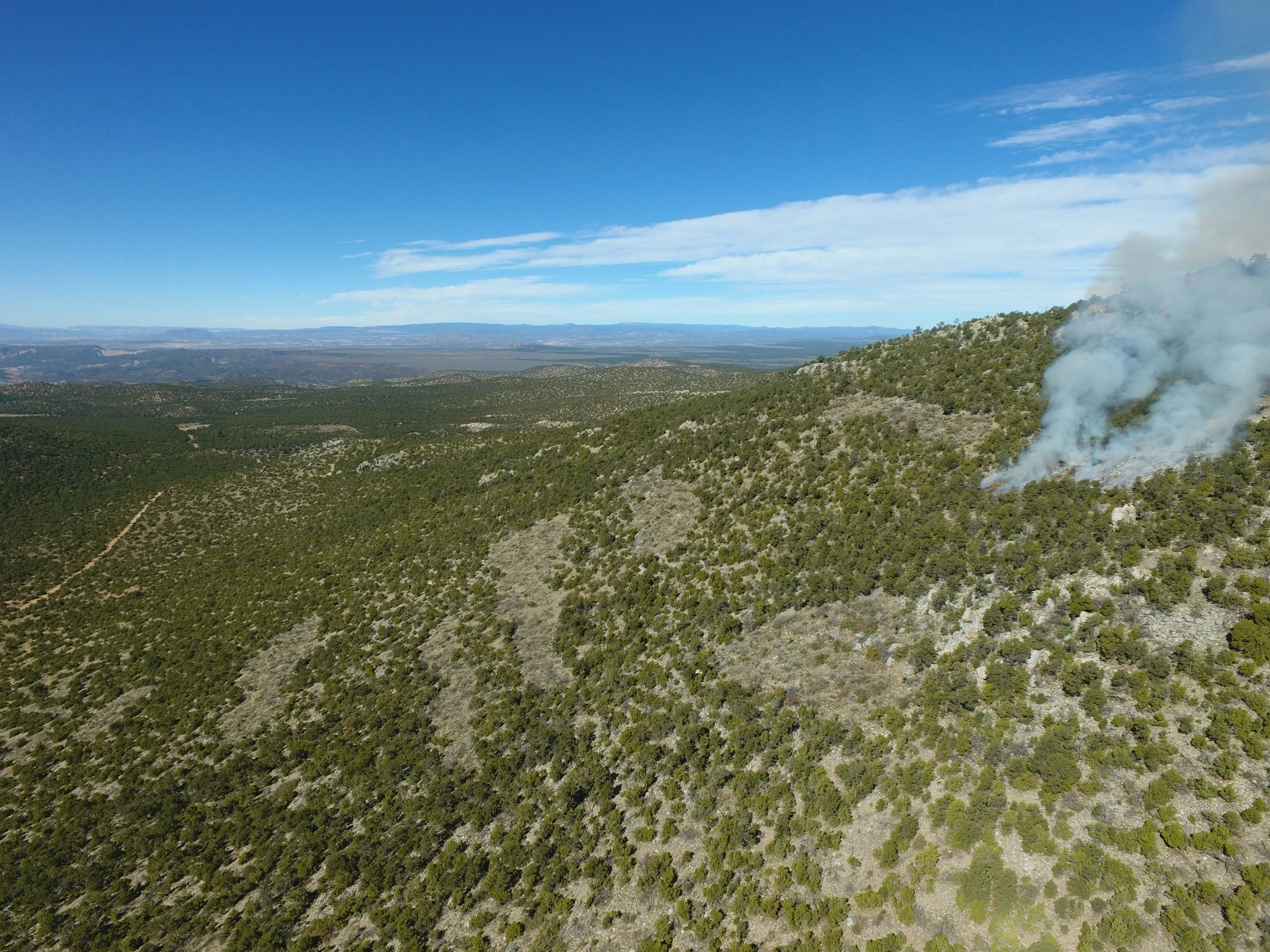
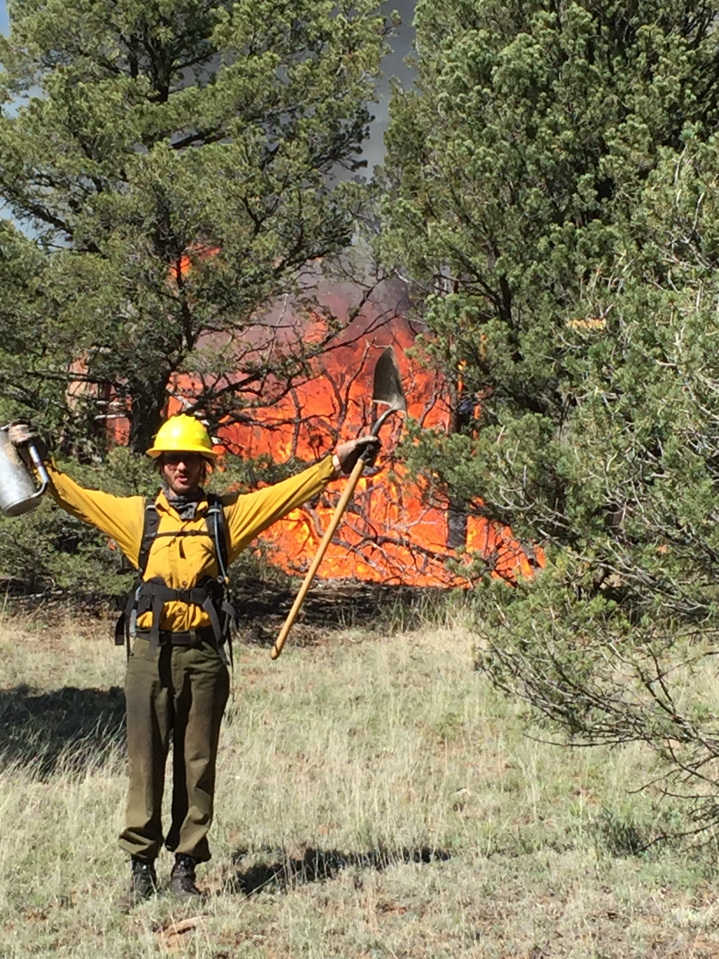
Fuelbreak: A fuelbreak is a strip of land where highly flammable vegetation is removed to reduce the wildfire threat. Fuelbreaks change fire behavior by slowing it down, reducing the length of fames and preventing the fire from reaching tree canopies. Fuelbreaks can improve the success of fire retardant dropped from the air, provide a safer area for firefighters to operate and allow for easier creation of firelines (a strip of bare ground established during a wildfire). Shaded and greenstrip are types of fuelbreaks. Community fuelbreaks are particularly effective when integrated with the defensible space of adjacent homes. They can be manmade or naturally occurring (rock outcrops, rivers and meadows).

Safe Area: A safe area is a designated location within a community where people can go to wait out a wildfire. Often, safe areas are ball fields, irrigated pastures, parks and parking lots.

Access

Use these Living With Fire concepts to engage your community in wildfire preparedness

Address: The home address should be readily visible from the street. The address sign should be made of reflective, noncombustible material with characters at least 4 inches high.

Gated Driveways: Electronically operated driveway gates require key access for local fire departments and districts.

Turnarounds: Homes located at the end of long driveways or dead-end roads should have turnaround areas suitable for large fire equipment. Turnarounds can be a cul-de-sac with at least a 45-foot radius or a location suitable for a 3-point turn.

Turnouts: Homes located at the end of long, narrow streets and dead ends can deter firefighters and complicate evacuation. If possible, create turnouts in the driveway and access roads that will allow two-way traffic. 

Driveway Clearance: Remove flammable vegetation extending at least 10 feet from both sides of the driveway. Overhead obstructions (overhanging branches and power lines) should be removed or raised to provide at least a 13½-foot vertical clearance.

Secondary Road: When communities only have one way in and out, evacuation of residents while emergency responders are arriving can result in traffic congestion and potentially dangerous driving conditions. A second access road, even one only used for emergency purposes, can improve traffic flow during a wildfire and provide an alternate escape route.

Street Signs: Street signs should be posted at each intersection leading to your home. Each sign should feature characters that are at least 4 inches high and should be made of reflective, noncombustible material.

Bridges and Culverts: Inadequately built bridges and culverts may prevent firefighting equipment from reaching your home. Ask your local fire marshal about proper bridge and culvert design for your area.

Road Width and Grade: Roads should be at least 20 feet wide and long driveways should be at least 12 feet wide with a steepness grade of less than 12 percent.

Defensible Space

Use these Living With Fire concepts to engage your community in wildfire preparedness

Wildland Fuel Reduction Area: This area usually lies beyond the residential landscape area and is where sagebrush, cheatgrass, piñon and other wild plants grow. Within this area:

·      Remove all dead vegetation (dead shrubs, dried grass and fallen branches).

·      Thin out thick shrubs and trees to create a separation between them.

·      Prevent ladder fuels by removing low tree branches, and removing or pruning any shrubs under the tree.

Noncombustible Area: Create a Noncombustible Area at least 5 feet wide around the base of your home. This area needs to have a very low potential for ignition from flying embers. Use irrigated herbaceous plants (lawn, ground cover and flowers), rock mulches, or hard surfaces (concrete, brick and pavers) in this area. Keep it free of woodpiles, wood mulches, dead plants, dried leaves and needles, flammable shrubs (sagebrush and juniper) and debris.

Lean, Clean and Green Area: For a distance of at least 30 feet from the home, there should be a lean, clean and green area. Lean indicates that only a small amount of flammable vegetation, if any, is present within 30 feet of the house. Clean means there is no accumulation of dead vegetation or flammable debris within the area. Green denotes that plants located within this area are kept healthy, green and irrigated during fire season. For most homeowners, the lean, clean and green area is the residential landscape. This area often has irrigation, contains ornamental plants and is routinely maintained.

Built Environment

Use these Living With Fire concepts to engage your community in wildfire preparedness

Eaves: Embers can accumulate under open eaves and enter the attic through gaps in construction materials. Covering the underside of the eaves with a soft, or boxing in the eaves, reduces the ember threat. Enclose eaves with fiber cement board or 5/8-inch-thick, high-grade plywood. If enclosing eaves is not possible, fill gaps under open eaves with caulk.  

Exterior Siding: Wood products (boards, panels and shingles) are common siding materials. However, they are combustible and not good choices for fire-prone areas. Noncombustible siding materials (stucco, brick, cement board and steel) are better choices. If using noncombustible siding materials is not feasible, keep siding in good condition and replace materials in poor condition.  

Windows and Skylights: Windows are one of the weakest parts of a home and usually break before the structure ignites. This allows burning embers and heat to enter the home, which may lead to internal ignition. Single-pane windows and large windows are particularly vulnerable. In high fire-hazard areas, install windows that are at least double-glazed and that utilize tempered glass for the exterior pane. The type of window frame (wood, aluminum or vinyl) is not as critical. However, vinyl frames should have metal reinforcements. Keep skylights free of pine needles leaves and other debris, and remove overhanging branches. If skylights are to be placed on steep pitched roofs that face large amounts of nearby fuels (a mature pine tree or another house), consider using flat ones constructed of double-pane glass.

Vents: Attic, eave and foundation vents are potential entry points for embers. All vent openings should be covered with 1/8-inch or smaller wire mesh. Another option is to install ember-resistant vents. Do not permanently cover vents, as they play a critical role in preventing wood rot.

Rain Gutters: Rain gutters trap flying embers. Always keep rain gutters free of leaves, needles and debris. Check and clean them several times during fire season.

Chimneys: Chimney and stovepipe openings should be screened with an approved spark arrestor cap.

Roof: Homes with wood-shake or shingle roofs are much more likely to be destroyed during a wildfire than homes with fire-resistant roofs. Consider replacing wood-shake or shingle roofs with a Class-A fire-resistant type (composition, metal or tile). Openings in roofing materials, such as the open ends of barrel tiles, should be plugged to prevent ember entry and debris accumulation. Regardless of the type of roof, including a flat roof, keep it free of fallen leaves, needles and branches.

Firewood: Firewood stacks should be located at least 30 feet from the home. If the stacks are stored uphill from the house, make sure that burning firewood cannot roll downhill and ignite the home. Consider using an ember-resistant firewood cover.

Decks: Decks using wood and wood-plastic materials are often combustible. Keep all deck materials in good condition. As an option, consider using fire-resistant rated materials. Routinely remove combustible debris (pine needles, leaves, twigs and weeds) from the gaps between deck boards and under the deck. Enclosing the sides of the deck may reduce this type of maintenance. Do not store combustible materials under the deck.

Flammable Items: Keep the porch, deck and other areas of the home free of easily combustible materials (baskets, dried flower arrangements, newspapers, pine needles and debris).

Engaging your neighbors in a conversation about how to improve community protection, access, defensible space, and the built environment around your home may make all the difference. By the time wildfire has started, it is too late. It takes leadership and initiative before the fire to save lives and protect property through wildfire adaptation. If you, or someone in your neighborhood has what it takes to develop these leadership skills, please reach out to Fire Adapted Communities New Mexico, and we can help support you in these challenging conversations. For more information email Gabe Kohler at gabe@forestguild.org.  

Additional Resources

 For a toolkit on being a community fire ambassador, check out: Santafefireshed.org/ambassador


After the Fire: Low Cost Flooding and Erosion Mitigation Strategies

By: Lindsey Quam, Santa Clara Pueblo Forestry Director and Gabe Kohler, Forest Stewards Guild Program Coordinator

Since wildfire is inevitable, the work to develop fire adapted communities is never done. This is why it’s so important that as a network we discuss strategies for adapting to wildfire before and after the fire. A recent Fire Adapted Communities New Mexico workshop in Santa Clara Pueblo focused on strategies for protecting our communities from flooding and erosion after a wildfire has occurred. Planning for after a wildfire may help shift conversation about wildfire potential from ‘if’ to ‘when’.

On May 24th, Fire Adapted Communities (FAC) leaders and partners from Santa Clara Pueblo in Northern New Mexico, gathered for an interactive workshop. It was a small, close-knit group  with representatives from 4 different organizations including Santa Clara Pueblo Forestry, The Santa Clara Office of Emergency Management, The Forest Stewards Guild, and Padilla Logging. The diverse group of partners and community members were able to productively identify lessons learned from the ongoing response and recovery efforts in Santa Clara Canyon following the 2011 Las Conchas wildfire.

A key goal of the FACNM network is to facilitate peer-to-peer information sharing to empower people to work toward wildfire adaptation in their communities. In addition to highly engineered, state-of-the-art erosion and flooding prevention structures, the pueblo implemented many low-cost structures. These low cost methods were part of a landscape scale effort to mitigate flooding and erosion after the Los Conchas fire, and are powerful tools for response and recovery that can be used to leverage the people-power in any community and make an impact against flooding and erosion before it occurs.

The project area is contained within the Santa Clara Creek Watershed and includes over 32,000 acres, 24 miles of stream, and 5,000 feet of elevation gradient.

The project area is contained within the Santa Clara Creek Watershed and includes over 32,000 acres, 24 miles of stream, and 5,000 feet of elevation gradient.

Stream-first Wildfire Recovery

The Las Conchas wildfire burned more than 150,000 acres adjacent to the community of Santa Clara, and created extreme flooding and erosion in Santa Clara Creek (more info here). Santa Clara Creek is regarded as a sacred source of life to the people of Santa Clara Pueblo,  so the Tribe took a ‘stream-first’ approach to prioritizing natural stream function. Its flood mitigation and restoration design emphasized the use of natural materials as infrastructure, which maximized ecosystem benefits and decreased the cost.

Erosion Control

Erosion control structures were installed in tributaries to stop sediment delivery upstream, minimize head cutting, and aggrade incised channels. The structures used were cost-effective, being built by hand and using on-site materials. The low cost of these methods allowed them to be used broadly throughout the project area, and over 5,300 structures were built in the 26 tributaries since 2014.

download (1).jpeg

Contour Felling

Felling trees along a horizontal contour is an easy and effective way to keep excess water out of a main drainage. These structures encourage lateral water flow and capture water to contribute to the water table.

Checkdam 2.jpg

Rockdam

Rocks are positioned to counteract erosion by reducing the velocity of water flow. These structures raise the level of the streambed, and create viable habitat for plants.

images (1).jpeg

Log Drop

Similar to rock dams, the log acts as a footer that is anchored into the banks of the incised channel. Rocks and dirt are placed upstream of the log and sometimes grass transplants are installed into the structure. These materials collect sediment behind the log structure and provide grade control. The sediment collected often contains organic material and other nutrients needed for healthy plant growth.

download (3).jpeg

Flow Splitter

These structures divert water flow out of a main incised channel and encourage sheet flow across the surface. These designs are most effective in wide valley bottoms where flow has space to spread and dissipate.

download.jpeg

Zuni Bowl

These structures are constructed at the base of a head-cut. Zuni bowls (originally used by Zuni Pueblo) armor the substrate within the channel, preventing scouring action by water over the long term. The bowl shape acts as an energy dissipater as water flows into the structure, protecting the potentially erosive substrate. The bottom of the bowl also acts as a water harvesting feature which will maintain moisture for long periods.

In New Mexico, where wildfire season is immediately followed by monsoons, planning for flooding and erosion mitigation is crucial to the resilience of our communities in the face of wildfire. Waiting for emergency assistance and outside funding may not be the best strategy for protecting our communities from flooding and erosion. The lost cost methods and materials used in Santa Clara Pueblo may be an important part of your communities after-the-fire toolkit.  

For more information about recovery after-the-fire, check out:

1.   Story map of Santa Clara’s response and recovery efforts to the Las Conchas Wildfire

 https://arcg.is/0HGPHf

2. After the Wildfire NM

https://afterwildfirenm.org/

https://afterwildfirenm.org/post-fire-treatments/treatment-descriptions/channel-treatments

3. The Burned Area Learning Network (BALN) https://www.conservationgateway.org/ConservationPractices/FireLandscapes/FireLearningNetwork/RegionalNetworks/Pages/BALN.aspx


Greetings FAC Members!

My first prescribed burn at Fort Union Ranch!

My first prescribed burn at Fort Union Ranch!

Hello Everyone,  

I am relatively new to this work, and would like to introduce myself. My name is Gabe Kohler and I am a recent addition to the Forest Stewards Guild as a program coordinator. As part of my work with the Guild, I am committed to increasing engagement of current FACNM members as well as outreach to new members. I hope my passion and enthusiasm for this work can be a resource to you all. I recently moved to Santa Fe in October from western Oregon where I finished graduate school at the Oregon State University (OSU) College of Forestry. I am fascinated by the deep connections between humans and their natural environment in the face of climate change and forests shaped by the legacy of past management. It is a privilege to work with you all, and I look forward to meeting each of you.

Thank you all for your continued support and engagement with the Fire Adapted Communities network. Some of you have been with this effort from the beginning and have been critical to advancing our relationship with wildfire for decades.

Fire Adapted Communities New Mexico (FACNM) is gaining diverse membership and support across the state and this reflects the ongoing efforts in each of your communities. In both human and natural systems, networks hold potential for adaptation, resilience, and creative problem solving that is greater than the sum of their parts. The FACNM network is no different, and by fostering relationships amongst motivated individuals we hope to catalyze and empower wildfire adaptation in our communities.

If there is anything that FACNM can do to amplify the work you all are doing in your communities of place or interest, please do not hesitate to reach out. I can be reached on my cell at 509-844-3048 or by email at gabe@forestguild.org.

Keep up the good work,

Gabe

Video about how one community's actions to prepare for wildfire stopped the 416 Fire


fire416.jpg

In June 2018, when the 416 Fire raged north of Durango, scorching tens of thousands of acres, the Falls Creek Ranch neighborhood, a Firewise USA community, was ready. Residents had prepared for the worst through several years of fire mitigation efforts such as clearing brush and overly dense trees, led by a Neighborhood Ambassador from Wildfire Adapted Partnership based in Southern Colorado and guided by a Community Wildfire Protection Plan. As a direct result of their efforts, firefighters could safely combat the eventual arrival of the fire. No structures were lost!

Watch the video here!


Wildfire Guides for Fire Chiefs and County Officials up on the FAC NM Website.

Two new resources to boost your wildfire preparedness are now up on the FAC NM website.

Fire Chief Wildfire Guide

The WUI Chief’s Guide was designed by fire chiefs for fire chiefs to help provide a better understanding of the wildland-urban interface and the necessary information to help prepare, mitigate, respond, and recover from these events. This guide was put together by a committee of fire chiefs led by Santa Fe New Mexico’s own fire chief Erik Litzenberg.


County Leadership Wildfire Guide

The County Leadership Guide to Help Communities Become More Fire Adapted and Learn to Live with Wildland Fire is great resource from our partners at National Association of Counties, Fire Adapted Communities Learning Network, Firewise USA, and Western Region National Cohesive Wildland Fire Management Strategy.

This resource provides tips for county leadership, talking points for county leadership pre, during and post fire season, and customizable social media suggestions.


Forest Bound: Free native plant and conservation training

The Santa Fe and Cibola National Forests, in collaboration with the Institute for Applied Ecology, have a great opportunity for youth to learn about native plants in New Mexico.

Ages 13-18

This fun, immersive program examines native plants through a botanical, environmental, and cultural lens. Students enjoy daily, hands-on experiences in the Santa Fe National Forest or Cibola National Forest. They will gain skills such as seed collection and cleaning, plant monitoring, identification, and ethnobotany. They will learn about conservation careers through conversations with professional conservationists and environmental leaders. At the end of the course, students will receive a certification of completion in basic native plant ecology.

Session dates

Santa Fe:

June 17-21

July 22-26 (session full)

Albuquerque:

June 3-7

July 8-12

For more information visit: www.appliedeco.org/get-outdoors

 
IAE-logo-2lines_409x100.png
FS_logo.png

Fire Adapted New Mexico Calendar - Find & post wildfire related events!

Hello all!

We’re populating the FACNM calendar on the website with all the Fire Adapted Communities related events that are happening around New Mexico. Click the link below to see the what’s your partners around the state are planing for this year.

https://facnm.org/events/

This is a place to find and post local, regional, and statewide events that are related to wildfire response in any way such as, movie showings, community events, CWPP meetings, fire service conferences, home hazard assessment trainings, etc.

But I can use your help! If you are hosting or know about an event that you think FACNM members would be interested in please let me know and I’ll post it to the site.

All I need is a:

  • What is the event called?

  • When is it?

  • Where is it?

  • A quick explanation of the event.

  • A website or contact information.

Email all of the above to sam@forestguild.org

Thanks!

$500 awards available to support Wildfire Community Preparedness Day! Applications due March 1st

Wildfire Community Preparedness Day is an annual campaign that encourages people to come together on a single day to take action to reduce their wildfire risk. On May 4th this year communities and organizations across the county will engage in huge variety of activities from community chipper days to potlucks and discussions about reducing fire risk. For more information, ideas of events, and resources click below:

Wildfire Community Preparedness day page at NFPA .

To support Wildfire Preparedness Day NFPA and State Farm are offering $500 grants to fund wildfire risk reduction activities. Check this link below for information about applying. On the NFPA website there are tips about how to apply and examples of past projects that have succeeded, and see our previous blog post about ideas for events!

MINI GRANT APPLICATION

2019PrepDaySaveTheDateFlyer-1.jpg

Goats help to mitigate wildfires

Krys Nystrom, executive director of the Wildfire Network, and Amanita Thorp of Horned Goat Landscaping, are using a unique approach to reduce fuels in the foothills of Albuquerque. We often focus on removing trees to prevent fires, but reducing fine fuels like grasses and shrubs can be just as important, especially if that is the main type of fuel that will carry fire in your neighborhood.

Wildfire, Insurance, and Development in the West.

Home insurance is shifting to adapt to the escalating scale of losses due to wildfire. This issue is sometimes overlooked as the tragedy fires in California and across the west unfold, but it’s becoming more prevalent and is directly affecting some property owners. Insurance is one of the levers that drives development and migration in areas adjacent to fire prone landscapes and puts pressure on these homeowners to mitigate their fire risk. The two articles below shed some light on how changes in insurer’s policies are impacting how home owners are adapting to wildfire and recovering from megafires.   

“As wildfire risk increases in Colorado and the West, home insurance grows harder to find”

This recent article from the Denver Post by Sophie Quinton dose an excellent job of investigating the issues of insurance and wildfire risk. It includes some unique perspectives from Bill Trimarco of the Wildfire Adapted Partnership and a solid endorsement of Wildfire Partners (in Boulder), two groups that are deeply committed to wildfire mitigation in Colorado. (click the orange title above to go to the article)

“Does Insurance Affect Home Development on Wildfire-Prone Lands?”

Headwaters Economics recently conducted an academic review of whether insurance influences development on fire prone lands. Two of their main conclusions were that:

·         A review of studies, anecdotal evidence, news articles, conversations with insurance industry experts, and analysis of trends indicates it is unlikely that insurance rates and policies alone will determine whether or not a landowner decides to build a new home on wildfire-prone land.

·         The most likely way that insurance companies will play a role in reducing wildfire risk is by developing financial rewards, such as lower rates, that are tied to fire-safe practices such as the use of flame-retardant building materials, creation of defensible space, and reduction of flammable fuels near homes.

(click the orange title above to go to the article)

photo from Arizona Department of Water Resources

Wildland Urban Fire Summit survey - Help us plan for the future!

IMG_7746.JPG

The Wildland Urban Fire Planning Committee is asking for your help as we develop future meetings. Your suggestions will help shape future Wildland Urban Fire Summits to better suit your needs.

20180505_104732.jpg

Please click on the link below to answer a short anonymous questionnaire that will assist our team. We also encourage you to forward the survey to anyone who might be interested, so we can collect as many responses as possible. We value your input.


https://www.surveymonkey.com/r/CWB92HL


The WUFS Strategic Planning Committee thanks you!

The Guild's All Hands All Lands burn team starts out strong

2018 is the inaugural year of the Guild's innovative All Hands All Lands burn team. 

A summary of work (at right) shows the amazing good fire results this year as part of the new coordination of effort, skills, partners and resources. 

View this video by the Fire Adapted Communities Learning Network! The video shares information and results from recent Prescribed Fire Training Exchanges (TREX) and also features the Guild's All Hands All Lands burn team coordination (starting at about 1:35 time in the video).

Bringing good fire back to fire adapted landscapes requires lots of training and partnerships. The materials above display some of the results of such collaborative efforts. Enjoy!

Thank you to all who support this essential and growing area of restoration management and wildfire prevention.

FAC practitioners gather in Santa Fe for asset mapping workshop

Workshop participants. Top row from left, Sam berry, Tim Kirkpatrick, Rebecca Samulski, Matt Cook. Bottom row from right, Porfirio Chavarria, Shirley Piqosa, Marlita Reddy-Hjelmfelt, Jana Carp, Hamilton Brown, Matt Piccarello

Workshop participants. Top row from left, Sam berry, Tim Kirkpatrick, Rebecca Samulski, Matt Cook. Bottom row from right, Porfirio Chavarria, Shirley Piqosa, Marlita Reddy-Hjelmfelt, Jana Carp, Hamilton Brown, Matt Piccarello

It can be easy to discuss fire adaptation only in terms of the problems that need solving: overgrown forests, climate change, the wildland urban interface, etc. In doing so, we fail to recognize the strengths and capacity within our communities that – without the intervention of fire experts or outside funding – make it possible to incorporate living safely with fire part of everyday life.  The Mapping community assets to build wildfire resilience workshop, which was held June 26-28 in Santa Fe, provided participants a needed change in perspective from which to approach community fire adaptation work. One that starts by asking communities to plan from a place of strength by identifying their assets and mobilizing them to address their wildfire resilience needs.

Jana Carp leads participants in discussion 

Jana Carp leads participants in discussion 

Workshop participants represented non-governmental organizations, local fire departments, tribal forestry programs, and their communities. The workshop was led by Jana Carp of Community Fire, based in Petaluma, CA. Jana brought over 20-years experience working in asset-based community development (ABCD) to Santa Fe. Over the last two years Jana has worked to bring an ABCD approach to fire adaptation. An ABCD approach to fire adaptation “considers local assets as the primary building blocks of sustainable community development.” This philosophy is right in line with the vision for the FAC NM that recognizes “there is a lot of experience and knowledge in our formal and informal networks” and by offering technological solutions and tools for FAC members to connect we enable greater collective action.

Participants identified their assets using an exercise they can bring back to their respective communities. 

Participants identified their assets using an exercise they can bring back to their respective communities. 

Throughout the workshop, participants explored their own assets and practiced exercises that can be conducted with communities to help them identify their own strengths and capacity. An important thing to remember about ABCD is that no matter what the context, be it wildfire issues or urban community development, community strengths are not limited to what is “typical” for addressing those issues. Having a neighbor with a chainsaw is certainly useful to help reduce hazardous fuel loads, but there is a role for everyone in fire adaptation regardless of their experience in forestry or wildfire. An artist can help design the flier for your community preparedness meeting, the school teacher can help create education materials for the kids in the neighborhood etc. Most importantly, encourage community members to identify their own assets as just about everyone has   interests and skills beyond what one might expect.

While the workshop provided participants with tools they can use to help communities identify their assets, perhaps more importantly, it helped participants change the way they approach fire adaptation. If we are going to promote Fire Adapted Communities as a way to live with fire, then our efforts should reflect this more positive approach that builds on existing strengths to encourage collective action. Workshop participants agreed to re-connect in September 2018 to check-in and share how they have used what they learned to affect change in their communities. Stay tuned!

Additional resources

Notes for participants

The Town's Abuzz: Collaborative Opportunities for Environmental Professionals in the Slow City Movement

Overview of Asset-Based Community Development (ABCD)

Situation Assessment (ABCD)

Asset Mapping with Connectors (ABCD)

Fire Adapted New Mexico Powerpoint presentation 

FAC NM updates: Member profiles and Asset mapping workshop registration

Greetings FAC NM Members! 

Since our official launch at the New Mexico Wildland Urban Fire Summit (WUFS) in April, FAC NM we've been working to update www.facnm.org with content and member profiles from folks that signed up at the summit. If you have yet to sign up to be a member please do so here. Be sure to indicate whether you are interested in becoming a FAC Leader. The rollout of the FAC Leader program is on track for this summer. To view our updated member profiles, check out the FAC NM Member directory here.

We've also added new content to the resources page, such as Resources for Private Forest Landowners in New Mexico guide. Based on feedback received at the WUFS, we've added a "current projects" where partners and FAC NM members can share or find projects and funding opportunities for reducing wildfire risk and improving forest resilience. One current project, Landowner engagement in critical watersheds, provides assistance to forest landowners by offering a home hazard assessment and/or forest resilience assessment for their property. If you are interested in having an assessment done, click on the link above and complete the landowner support form.  

Registration is open for the asset-mapping workshop!

Join us June 26-28 in Santa Fe for the Mapping Community Assets to Build Wildfire Resilience workshop. If you are interested in participating, please complete the registration form available on the events page

Thanks to everyone who has joined FAC NM as a member and for all the input we received in the lead up to and during the WUFS. Like fire adaptation, our work to improve the network will never be done. We will continue to develop partnerships to increase wildfire resilience and make the network work for it's members. Don't forget to join the FAC NM forum and post your ideas for how to improve the network! 

From everyone at FAC NM, have a safe and fun summer!


Save the date!! Mapping Community Assets to Build Wildfire Resilience

Mapping Community Assets to Build Wildfire Resilience - June 26-28 in Santa Fe

Save the date for our first Fire Adapted New Mexico community workshop featuring community asset-mapping, a strategy for finding and connecting community strengths to build local capacity to live well with fire.

The 2.5 day workshop will cover basic principles of community asset mapping and guide individuals and groups in devising ways to apply hands-on practices where they live and work.  Participants will develop a practical understanding of how community asset mapping can support and advance their fire adaptation goals, and how to avoid common pitfalls of working with grass-roots initiatives. While the workshop will emphasize fire adaptation and resilience, community asset mapping is a useful approach to addressing other community planning challenges.

The workshop will be facilitated by Jana Carp, who has been working in asset-based community development for 20 years and now works with communities threatened by wildfire in Northern California. 

No specific prior knowledge or experience is needed. 

FAC Leaders Network Webinar #1

DSCF3546.JPG

Fireadapted NM is developing a FAC Leader's Network! A series of webinars with FAC partners will focus on developing the Leader's Network, training materials, and training curriculum. You access a recording of the first webinar at https://www.youtube.com/watch?v=VBsr72I5cis&t=8s. If you are interested in participating in future webinars please contact Matt Piccarello at matt@forestguild.org